11/16/2024
11/16/2024
Landmark information
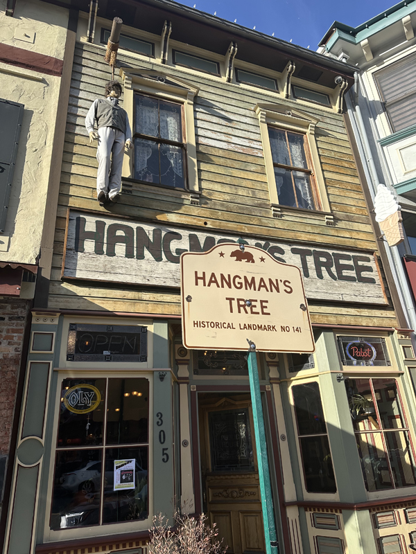
- Location:
305 Main St, Placerville - Plaque:
Other Plaque - Site:
Existing - Date First Visited:
12/27/1995 - Date Most Recently Visited:
11/16/2024 - GPS Coordinates:
N 38 43.700, W 120 48.143
About this landmark
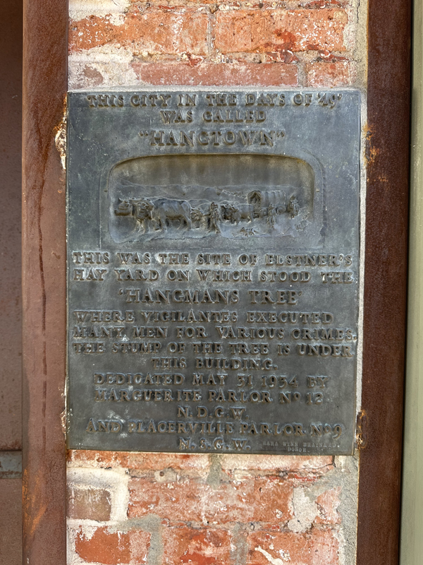
Plaque text:
This city in the days of '49 was called "Hangtown"
This was the site of Elstner's hay yard on which stood the 'hangman's tree' where vigilantes executed many men for various crimes. The stump of the tree is under this building.