6/20/1998
Landmark information
- Location:
Hwy 26 (PM 32.3), 2.1 mi W of West Point - Plaque:
Other Plaque - Site:
Nothing Remains - Date First Visited:
6/20/1998 - Date Most Recently Visited:
6/20/1998 - GPS Coordinates:
N 38 22.748, W 120 32.412
About this landmark
Plaque text:
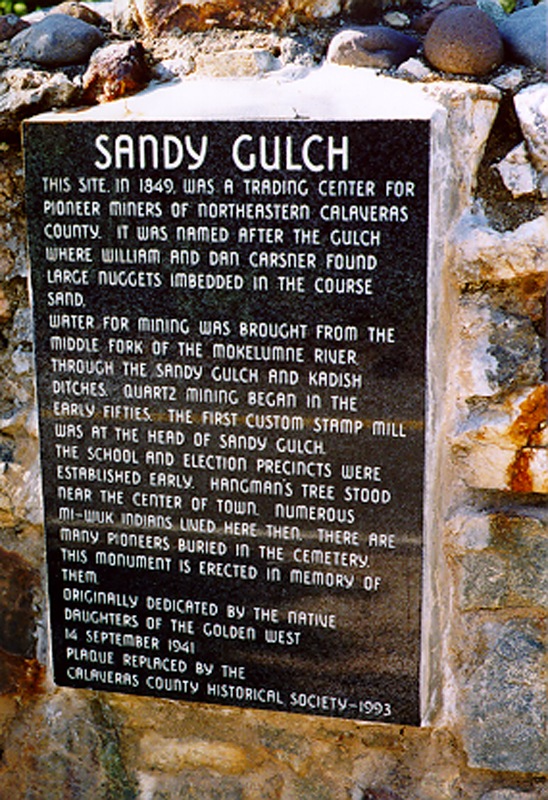
Sandy Gulch
This site, in 1849, was a trading center for pioneer miners of northeastern Calaveras County. It was named after the gulch where William and Dan Carsner found large nuggets imbedded in the course sand.
Water for mining was brought from the Middle Fork of the Mokelumne River through the Sandy Gulch and Kadish ditches. Quartz mining began in the early fifties. The first custom stamp mill was at the end of Sandy Gulch. The school and election precincts were established early. Hangman's tree stood near the center of town. Numerous Mi-Wuk Indians lived here then. There are many pioneers buried in the cemetery. This monument is erected in memory of them.