2/17/1997
Landmark information
- Location:
S Camanche Shore Park, Monument RV Park near S entrance, Camanche Parkway South, 3 mi NW of Burson - Plaque:
Official State Plaque - Site:
Nothing Remains - Date First Visited:
2/17/1997 - Date Most Recently Visited:
2/17/1997 - GPS Coordinates:
N 38 12.762, W 120 55.367
About this landmark
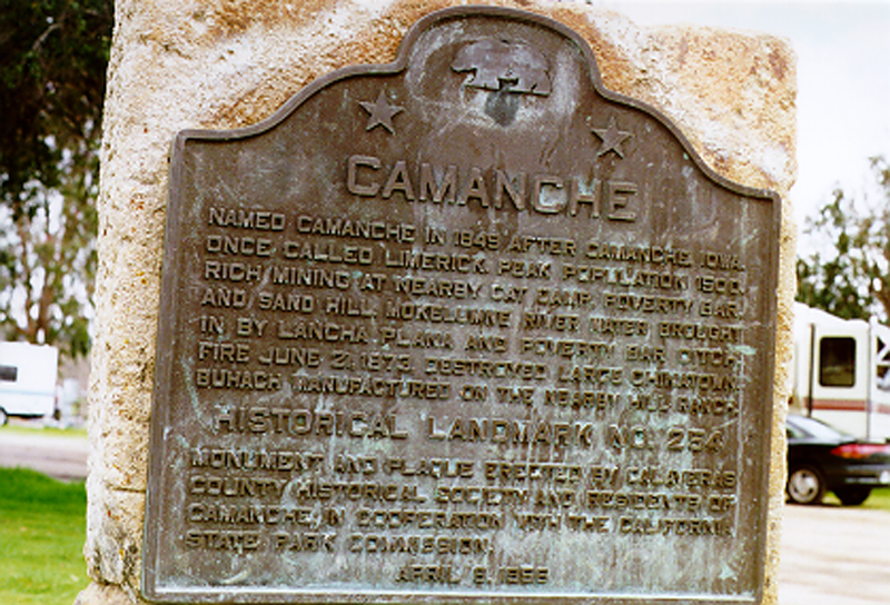
Plaque text:
Camanche
Named Camanche in 1849 after Camanche, Iowa. Once called Limerick Peak population 1500. Rich mining at nearby Cat Camp, Poverty Bar, and Sand Hill. Mokelumne River water brought in by Lancha Plana and Poverty Bar ditch. Fire June 21, 1873, destroyed large Chinatown. Buhach manufactured on the nearby Hill Ranch.