3/20/2005
Landmark information
- Location:
On State Hwy 49 (PM 14.0) at San Antonio Creek, 5 mi S of San Andreas - Plaque:
Official State Plaque - Site:
Nothing Remains - Date First Visited:
5/26/1996 - Date Most Recently Visited:
1/16/2025 - GPS Coordinates:
N 38 7.836, W 120 38.072
About this landmark
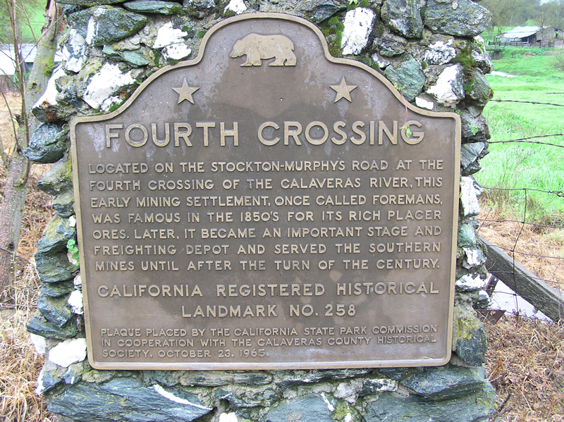
Plaque text:
Fourth Crossing
Located on the Stockton-Murphys Road at the fourth crossing of the Calaveras River, this early mining settlement, once called Foremans, was famous in the 1850s for its rich placer ores. Later, it became an important stage and freighting depot and served the southern mines until after the turn of the century.