3/17/2000
Landmark information
- Location:
County Hwy 48 (PM 0.3), O'Byrne Ferry Rd, 7.1 mi SE of Copperopolis - Plaque:
Other Plaque - Site:
Nothing Remains - Date First Visited:
3/17/2000 - Date Most Recently Visited:
3/17/2000 - GPS Coordinates:
N 37 53.955, W 120 34.279
About this landmark
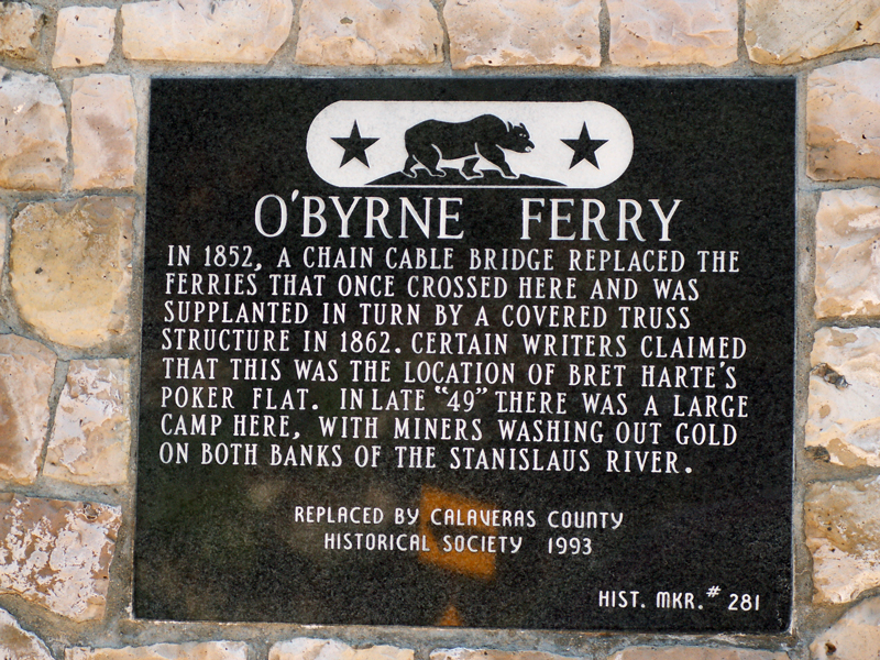
Plaque text:
O'Byrne Ferry
In 1852, a chain cable bridge replaced the ferries that once crossed here and was supplanted in turn by a covered truss structure in 1862. Certain writers claimed that this was the location of Bret Harte's Poker Flat. In late "49" there was a large camp there, with miners washing out gold on both banks of the Stanislaus River.