5/21/1997
Landmark information
- Location:
SW corner of county Hwy M109 (Old Springville Stage Route) and county Hwy M12, 8 mi S of Fountain Springs - Plaque:
Official State Plaque - Site:
Nothing Remains - Date First Visited:
5/21/1997 - Date Most Recently Visited:
5/21/1997 - GPS Coordinates:
N 35 48.715, W 118 50.65
About this landmark
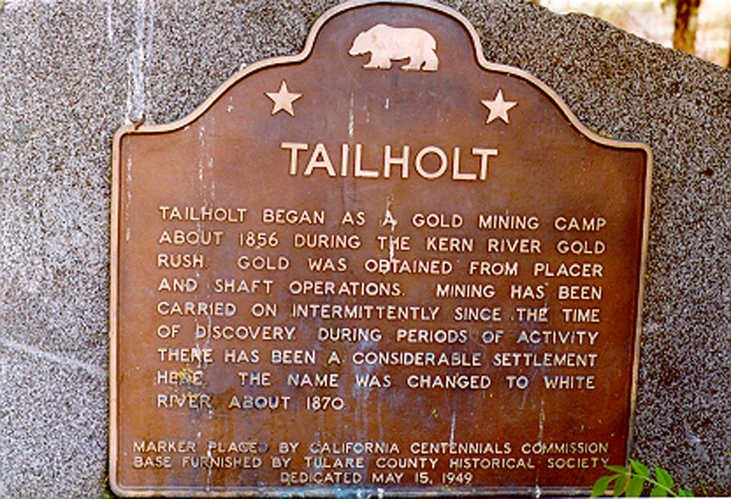
Plaque text:
Tailholt
Tailholt began as a gold mining camp about 1856 during the Kern River gold rush. Gold was obtained from placer and shaft operations. Mining has been carried on intermittently since the time of discovery. During periods of inactivity there has been a considerable settlement here. The name was changed to White River about 1870.