6/12/2002
Landmark information
- Location:
Hwy 97 (PM 14.5), at Military Pass Rd, 14.5 mi NE of Weed - Plaque:
Official State Plaque - Site:
Nothing Remains - Date First Visited:
6/12/2002 - Date Most Recently Visited:
6/12/2002 - GPS Coordinates:
N 41 33.505, W 122 12.581
About this landmark
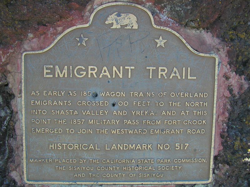
Plaque text:
Emigrant Trail
As early as 1852 wagon trains of overland emigrants crossed 600 feet to the north into Shasta Valley and Yreka, and at this point the 1857 military pass from Fort Crook emerged to join the westward emigrant road.