3/11/1997
Landmark information
- Location:
Carnegie State Vehicular Recreation Area, 5.9 mi W of I-580 on Corral Hollow Rd, 9 mi SW of Tracy - Plaque:
Official State Plaque - Site:
Nothing Remains - Date First Visited:
3/11/1997 - Date Most Recently Visited:
3/11/1997 - GPS Coordinates:
N 37 37.982, W 121 32.59
About this landmark
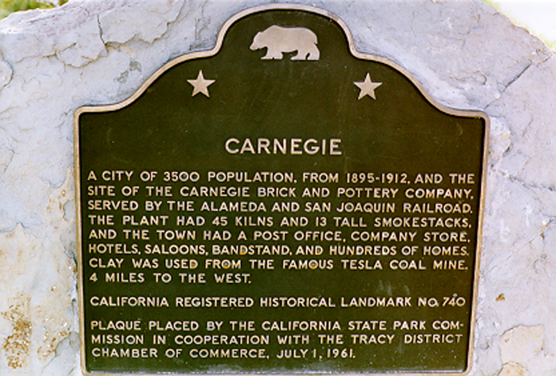
Plaque text:
Carnegie
A city of 3500 population, from 1895-1912, and the site of the Carnegie Brick and Pottery Company. Served by the Alameda and San Joaquin Railroad, the plant had 45 kilns and 13 tall smokestacks, and the town had a post office, company store, hotels, saloons, bandstand, and hundreds of homes. Clay was used from the famous Tesla Coal Mine, 4 miles to the west.