2/12/2010
Landmark information
- Location:
Spencerville Rd, 3.9 mi E of Hwy 65, near Wheatland - Plaque:
Official State Plaque - Site:
Nothing remains - Date First Visited:
2/28/1999 - Date Most Recently Visited:
5/24/2008 - GPS Coordinates:
N 39 2.375, W 121 23.101
About this landmark
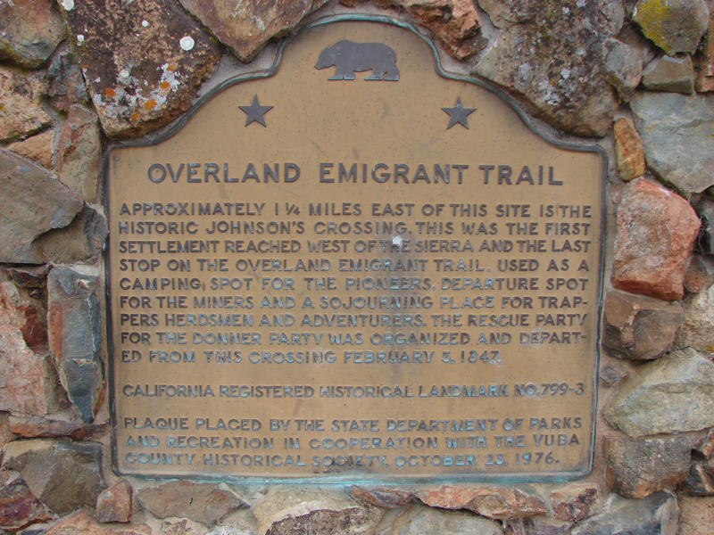
Plaque text:
Approximately 1 1/4 miles east of this site is the historic Johnson's Crossing. This was the first settlement reached west of the Sierra and the last stop on the Overland Emigrant Trail. Used as a camping spot for the pioneers, departure spot for the miners, and a sojourning place for trappers, herdsmen, and adventurers. The rescue party for the Donner Party was organized and departed from this crossing February 5, 1847.