1/4/2015
1/4/2015
Landmark information
- Location:
Death Valley National Park, from Hwy 190 (pm 92.1) go N 2.8 mi on unpaved sand dunes access rd, 6.1mi E of Stovepipe Wells - Plaque:
Official State Plaque - Site:
Existing - Date First Visited:
1/4/2015 - Date Most Recently Visited:
1/4/2015 - GPS Coordinates:
N 36 39.544, W 117 4.770
About this landmark
Plaque text:
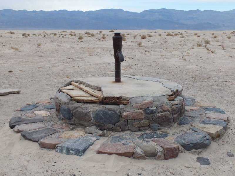
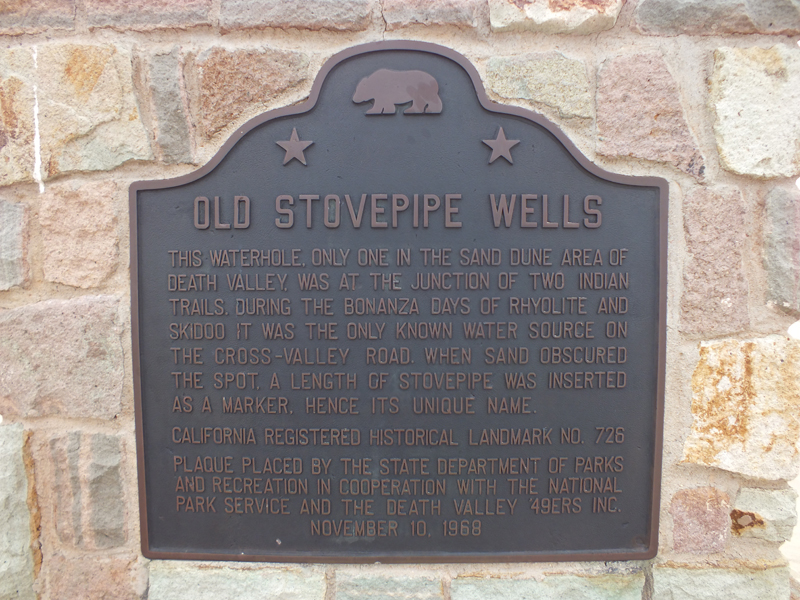
Old Stovepipe Wells
This waterhole, only one in the sand dune area of Death Valley, was at the junction of two Indian trails. During the bonanza days of Rhyolite and Skidoo it was the only known water source on the cross-valley road. When sand obscured the spot, a length of stovepipe was inserted as a marker, hence its unique name.