6/15/2004
Landmark information
- Location:
On County Rd S24, 0.2 mi W of intersection of Levee and Mehring Rds, 4.4 mi NE of Bard - Plaque:
Official State Plaque - Site:
Nothing Remains - Date First Visited:
5/21/1998 - Date Most Recently Visited:
6/15/2004 - GPS Coordinates:
N 32 48.982, W 114 30.905
About this landmark
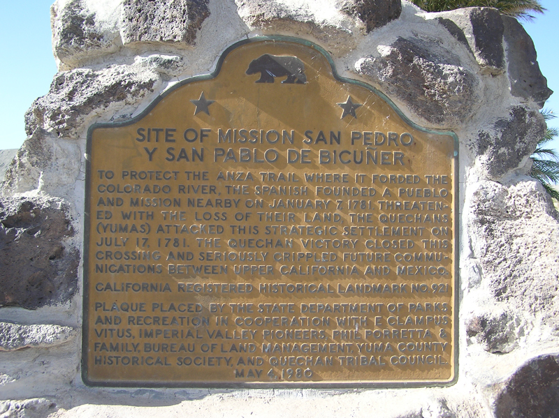
Plaque text:
Site of Mission San Pedro Y San Pablo De Bicuner
To protect the Anza trail where it forded the Colorado River, the Spanish founded a pueblo and mission nearby on January 7, 1781. Threatened with the loss of their land, the Quechans (Yumas) attacked this strategic settlement on July 17, 1781. The Quechan victory closed this crossing and seriously crippled future communications between upper California and Mexico.