2004 Arizona Trip

March 23 was Patti and my 20th anniversary. We had planned to drive down to Las Vegas for a couple of days to celebrate.
One evening Patti was talking on the phone to her sister Dianne who, with
her husband Wayne are permanent RV'rs. During the conversation Dianne mentioned that they
were going to be at the Organ Pipe Cactus National Monument in southern Arizona at the end
of March. Patti mentioned to me that it would be fun if we could meet them there. I
figured that since we were going to be in Las Vegas around that time, that we could easily
extend our trip to include a visit with her sister in Arizona and get to see some of the
Sonoran Desert.
Patti made arrangements with her daughter Dina to deposited her unemployment check
so we would have 3 weeks to make the trip.
Saturday 03,20
We fired up Pigpen and hit the road. The weather in Santa Rosa was hot when we left with
temperatures in the 90's. We got a late start because we had to wait for Patti's check to
arrive.
We took I-80 east toward Reno, Nevada where we planned to spent the first night with my
nephew John and his wife Cindy.
We made one detour to meet with our old friend Cactus Ass for dinner at the Nugget Cafe in
the little town of Cool, CA. on Hwy. 49.
After dinner we headed over Donor Pass to Reno where we had a nice visit with John
and Cindy and their 7 new puppies.
Sunday 03,21
We left Reno around 10:00 in the morning and drove to Fallon where we visited with Patti's
nephew Scot and his wife Cindy. We had lunch with them and visited for a while, then we
got back on the road heading for Vegas. We stopped in Tonapah for gas and dinner.
When we tried to leave the parking lot, Pigpen decided to developed a vapor-lock.
After a little investigation I decided that the problem was being caused by the fuel
filter. I eliminated the filter, fired up Pigpen and had no further problems.
We drove about 10 miles south of Tonapah where I found a dirt road heading west. We
followed this road for a mile or so and found another smaller dirt road to our right; we
followed this "track" for a little ways and pulled off on a flat spot where we
spent the night.
Monday, 03, 22
The morning was bright and warm. After a breakfast of Oatmeal for me and Slimfast for
Patti, we got back on the road heading for Vegas.
We arrived at the outskirts of Las Vegas around noon. After circling the town for a
while we finally managed to find our way to the hotel by making ever decreasing circles.
We had reservations for three nights at the Stratosphere Hotel. (after three days in Vegas
we were able to navigate around the town pretty well).
We checked in, had lunch in the buffet and then took a trolley to the Excaliber where we
made reservations for the Tournament of Kings dinner show on Wednesday at 6:00pm. We
had a late dinner at the Luxor (Alaskan Halibut) then got back on the trolley heading back
to the Stratosphere. The ride took over an hour. The trolley driver obviously used the
same navigation techniques as I did. He circled every block between the Luxor and the
Stratosphere at least three times.
Tuesday, 03,23
Today is our anniversary. We walked to the Sahara Hotel for breakfast.
I don't know about you but I can only take so much of crowds and casino's so we decided to
take a ride out of town to check out the local desert. We drove east on I-15 toward Utah.
About 50 miles out of Vegas we turned south at exit 75 to the Valley of Fire State Park.
(Here is where the Pictures start)
The Valley of Fire State Park is worth the drive from Las Vegas it costs $6.00 per car to
get in and if you want to camp, there are two campgrounds in the park at an additional
fee. The park has many hiking trails and lots of beautiful country to see.
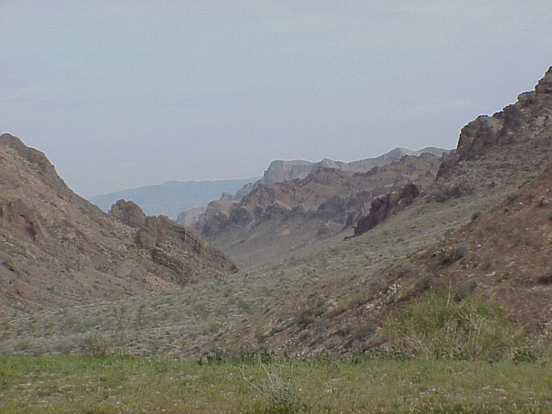


Entering V.O.F. Red rock country
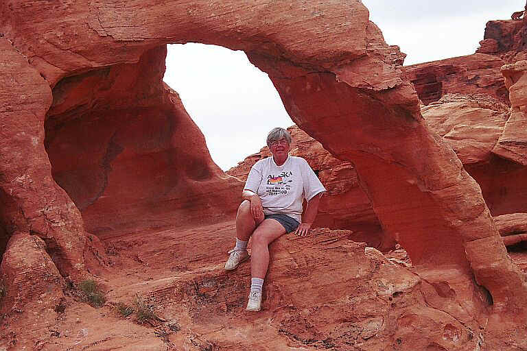
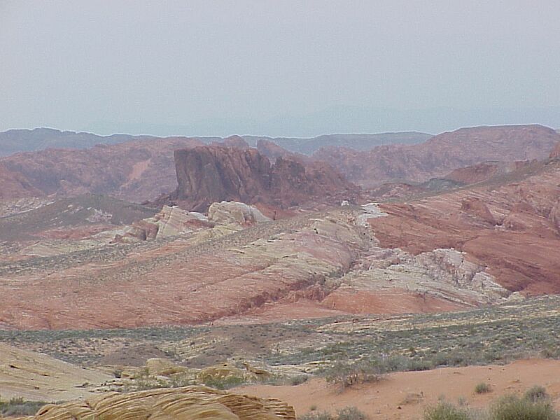
Sandstone Arch Red and Yellow Beautiful
colors Atlatl Rock
We got back to the Stratosphere around 5:30 and had dinner at the Roxy Diner. The Diner decorated in nineteen fifties style with loud music and singing waiters and waitresses. After dinner we took a city bus to Fremont street in the older part of town. Patti played Black Jack at the Las Vegas Casino and actually came out $25 ahead. I watched Patti play for a while and then went out to see the overhead light show. It was ok.
Wednesday 03,24
We drove pigpen to the Belogio Hotel/Casino. Picture that, Pigpen at the Belagio. He
looked a little out of place in the parking lot. This is definitely "Whale
country". "Whales" to the casinos are the really "High Rollers".
I decided that if whales are the big spenders then the rest of us must be
"Krill". The Belagio is definitely impressive with its gardens and butterflies
and expensive shops. Patti and I looked like we had just fallen of a turnip truck.
From the Belagio we went to the Excaliber for dinner at "The Tournament of
Kings". It was a fun dinner show. Very theatrical with jousting, sward fighting,
tumblers, pyrotechnics and pretty girls.
After dinner we went back to the Stratosphere and each of us lost $20 at the Black Jack
table. Ok, so now we have paid our "Nevada Taxes".
Thursday 03,25
We checked out of the hotel, ate breakfast and headed out of Vegas. We took Highway 93 and
crossed the Hover Dam. 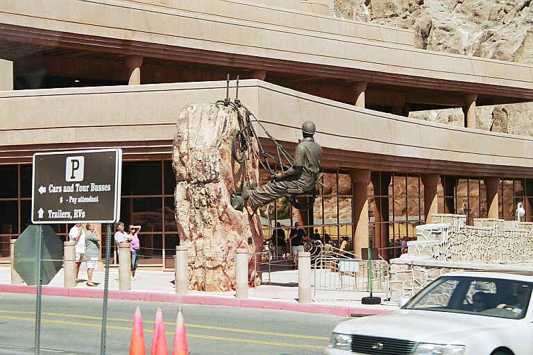
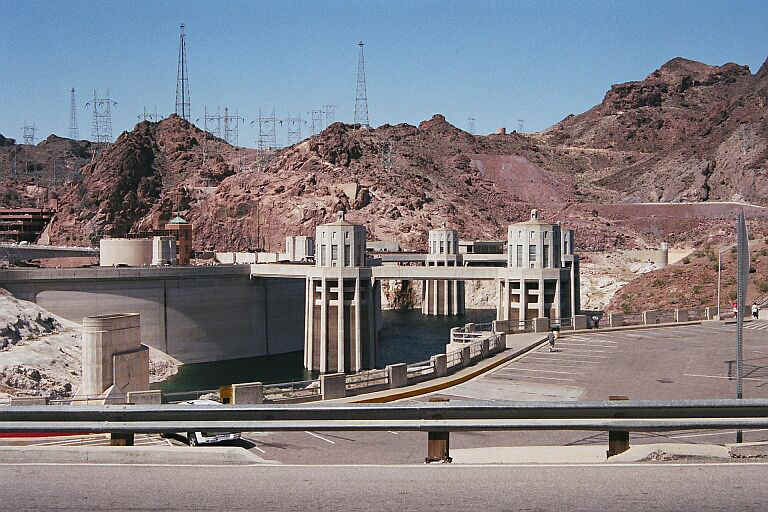
Before you cross the dam there is a security check point.
Of course they had us pull over to be checked out.
The officer who searched us was nice and was very taken by Pigpen. He thought it was
really cool that I had converted it to 4WD.
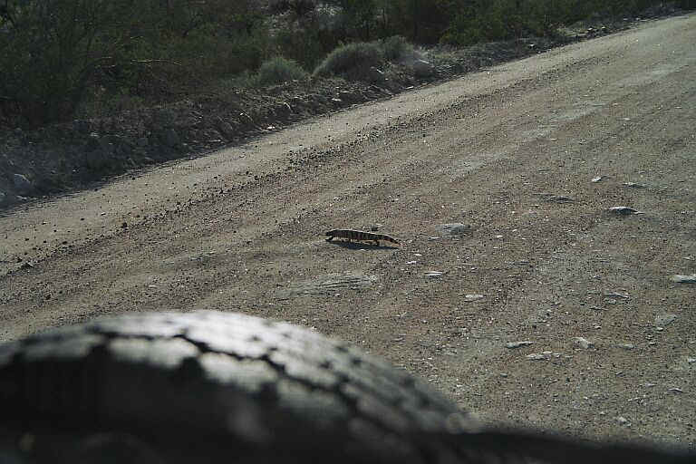
We continued south on 93 to Wikieup, AZ where we took a dirt road that goes to Alamo Lake.
We planned to camp, not at the lake but on the Bill William's River. After less than a
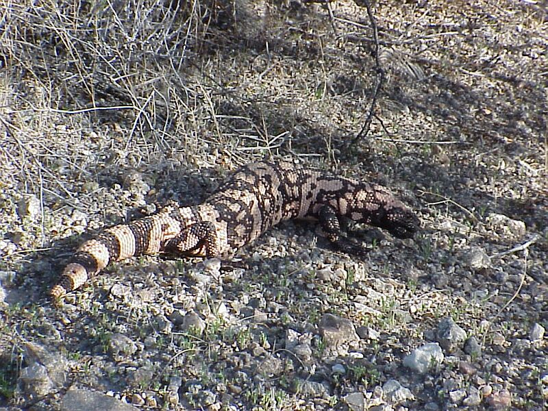
mile a we saw a Gila Monster crossing the road I slammed on the breaks and we jumped out
of the van to take some pictures. I had to coax him out from under a bush with a long
stick so I could get a better picture. He was not very happy with me poking him and hissed
loudly but finally he moved out in the open for the picture.
We drove for most of the day, trying to get to the river but within view of our goal we
came to a locked gate and "No Trespassing" signs. Apparently the river belongs
to the City of Scottsdale, AZ.
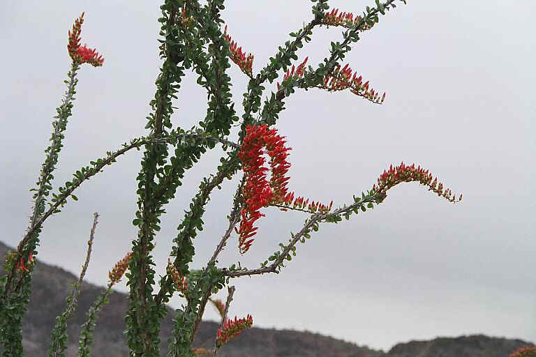
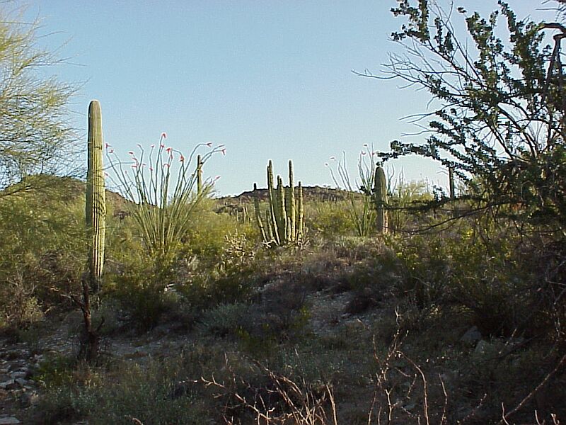
We got our first pictures of Ocotillo's in bloom. 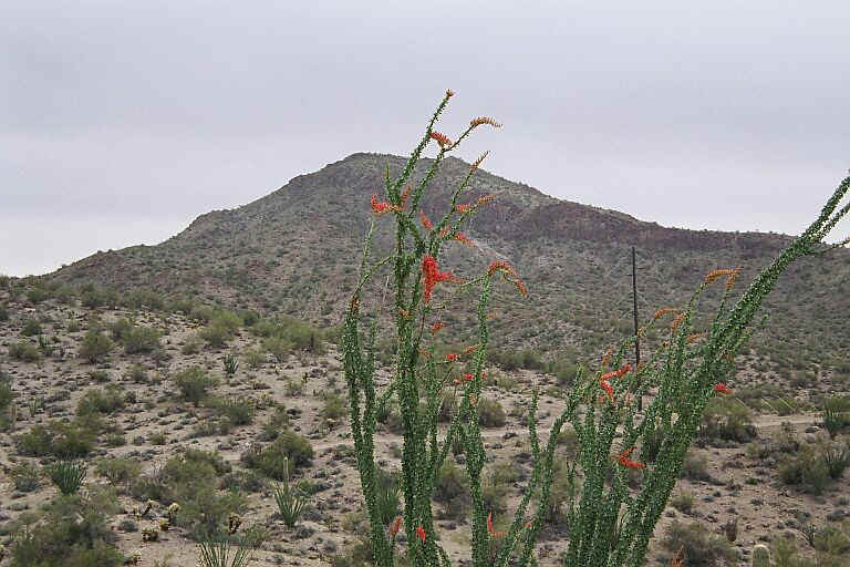
 and our first views of Saguaro's.
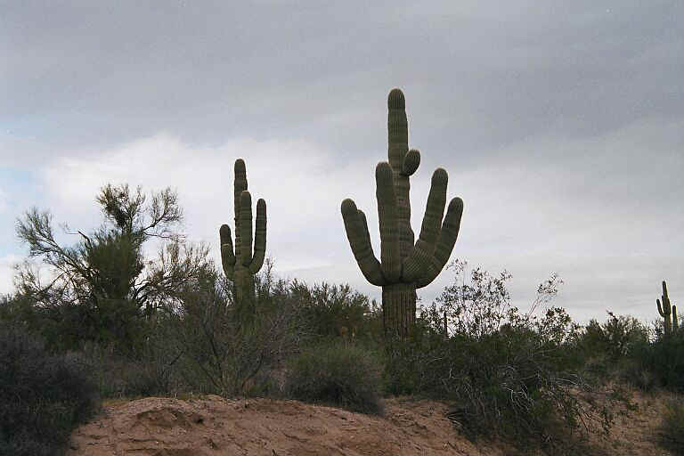
We headed back the way we had come and found a camp spot in the desert where we sat around
a nice camp fire and listened to the Coyote's singing until bed time.
Friday 03,26
Got an early start this morning. Drove to Gila Bend, AZ where we stopped for lunch and
gas. We headed south on Highway 85 to Ajo, AZ where we stopped to buy groceries then
continued south to Why, AZ.
We met up with Patti's sister Dianne and brother-in-law Wayne at the RV park at the Indian
casino at Why.
It had been almost a year since we had seen them so it was a happy reunion.
Saturday 03,27
The next morning we headed south again to the Organ Pipe Cactus National Monument which is
on the US, Mexican Border. 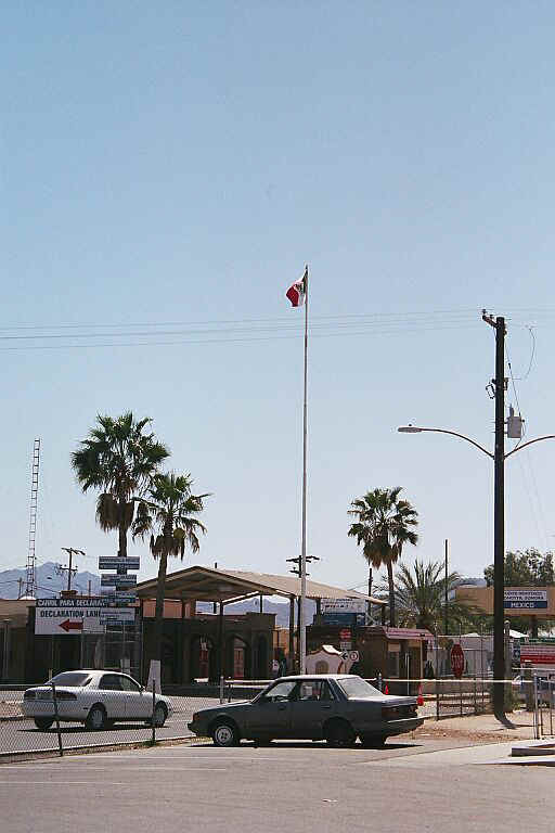 at Luke
Ville.
at Luke
Ville.
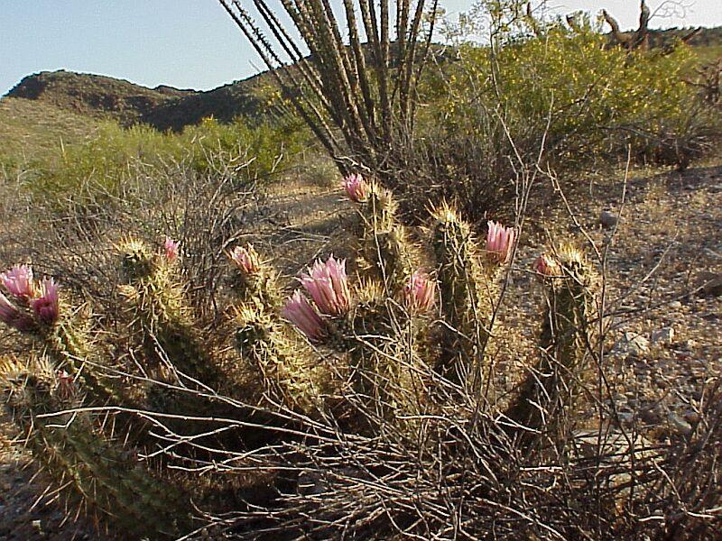
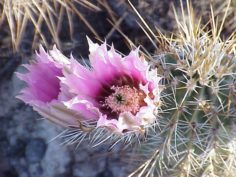
Shortly after we got our camps set up we saw another Gila Monster but we didn't get
pictures. Patti took the first of many pictures of Hedgehog Cactus's in bloom.
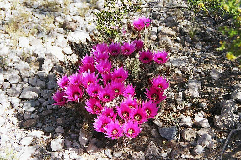
The desert here is very lush with lots of flowers. 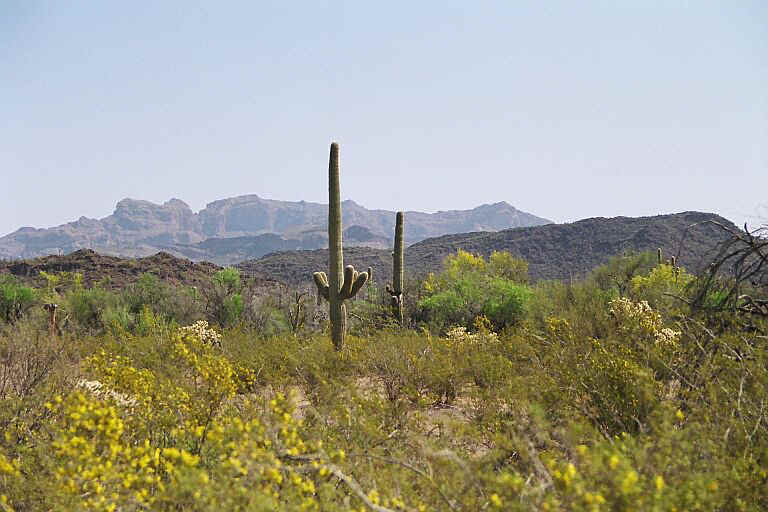
We were hoping to see the Organ Pipe Cactus's in bloom but they are late due to a very
cold winter. 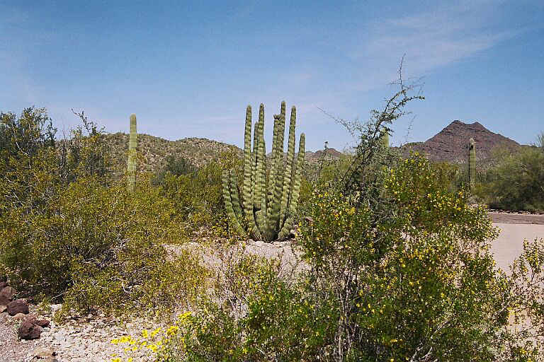
The Saguaro's don't bloom until mid May. 
Sunday 03,28
This morning we started on a 21 mile loop through the desert. It was beautiful and we saw
lots of cactus. The loop took us 6 hours to complete and we were very hot and tired when
we got back to the campground

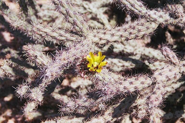

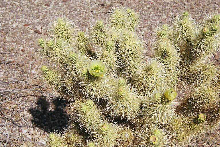

Hedgehog Staghorn
Cholla Buckhorn Cholla
Teddy bear Cholla Beavertail
Pincushion
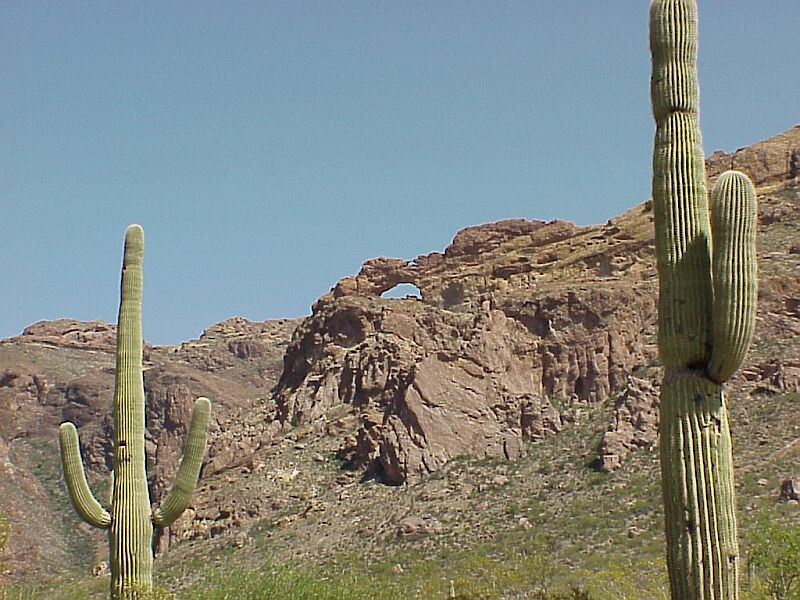
Saguaro's and Arch
Monday 03,29
I got up early this morning and took a walk in the desert where I shot some more pictures
of cactus.

Later on Patti and I took two more short rides. It is very hot, mid 90's. I had to dump
water over Patti to cool her down.
Dianne fixed Linguini with prawns for dinner. The evening was so hot that we slept with
all of Pigpens doors open.
Tuesday 03,30
The morning is already very warm. I walked up to the gate to pay for one more night.We
will be leaving tomorrow morning to start our homward leg of this adventure. We spent most
of the day hanging around camp and visiting with Dianne and Wayne.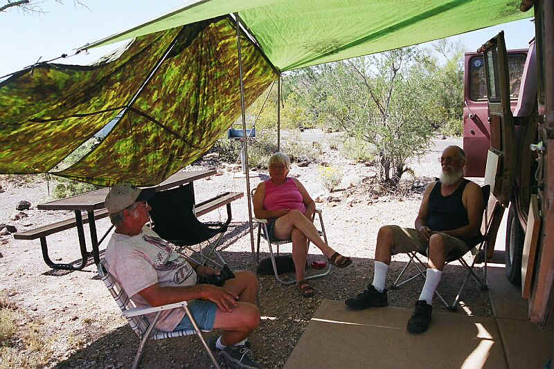
I checked out pigpen in preparation for tomorrows departure and found that the rear
"U" joint was slightly loose so I got out a wrench and tightened it.
Wednesday 03,31
Around 8:30 am. we said our good-byes to Dianne and Wayne and hit the road heading north.
We stopped at the RV park in Why and bought showers for $2.00. It was well worth it after
several days in the hot dusty desert. We stopped at Ajo, AZ. to buy groceries and fuel.
Just when we were about to leave the parking lot, Dianne and Wayne drove up. We said our
good-byes again and left Ajo.
Between Ajo and Gilla Bend there is a Border Patrole check point. Once
again the guy at the check point wanted to talk about Pigpen and how I had converted it.
We stopped at Gila Bend for lunch and to do laundry.
Left Gila Bend around 2:00 and headed west on I-8. After about 15 miles we took exit 102
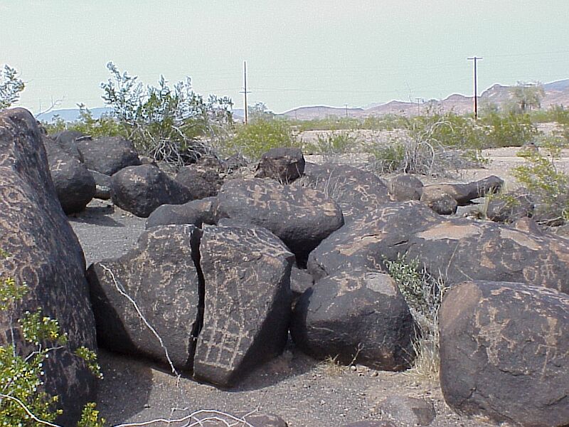
north and drove to the Painted Rocks Petroglyph Sight.
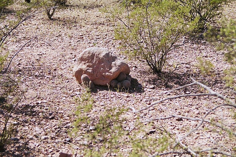
The Petroglyphs are on boulders that form a mound in the middle of no where. There is a
$2.00 admission charge so we paid the money and took the walk around the pile. There are
hundreds of petroglyphs.
Here are just a few: 

Unfortunately many of the Glyphs have been distorted or defaced.
This one looks like a depiction of a Mammoth but is it ancient or is it modern graffiti??  It looks real to me but I'm no expert.
If it is real that's pretty exciting.
It is very hot and dry. The ranger told us that they hadn't had any rain here since 1997.
(Two days later they had torrential rains and flash flooding)
We left the petroglyph sight and followed a dirt road west until we came to Agua Calente
Rd. where we turned south to I-8 and then turned west again. We followed I-8 to Welton
where we turned north through Dome Valley.
Dome Valley is a large agricultural area with a variety of crops. With all the irrigation
the temperature seemed somewhat cooler. We connected with Highway 95 and continued north
toward Quartzite, AZ.
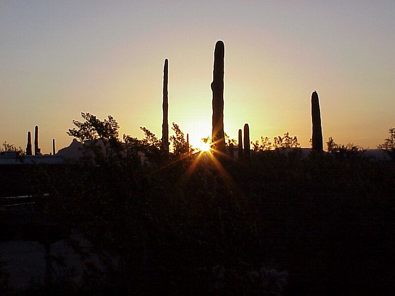
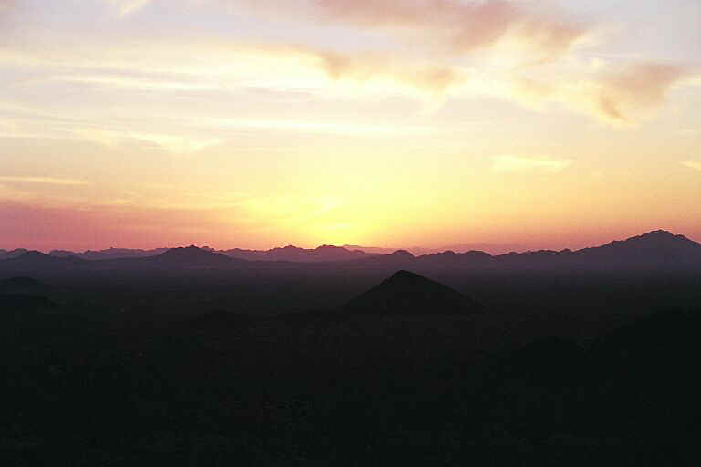
Around 6:00 pm. we turned off the highway and followed a dirt road into the Kofa National
Wildlife Preserve. We spent the night at the end of the road in Palm Canyon. We had
beautiful views of the desert sunset to the west
 and the red cliffs of Palm Canyon
behind us.
and the red cliffs of Palm Canyon
behind us.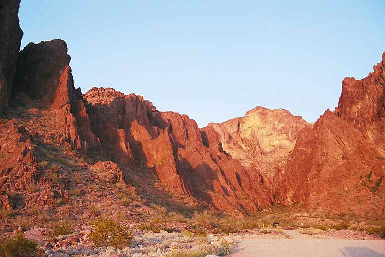
Thursday 04,01
I took a little walk up Palm Canyon in the morning and got a couple of pictures of flowers
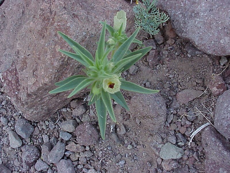 and cactus.
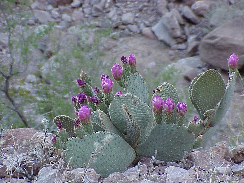
We drove to Quartzite where we got gas and then continued north on Highway 95.
We saw another dirt road on the map that looked like it went to the Bill William's River
so we decided to follow it and see if we could actually get to the river this time. The
road goes through the small town of Bouse, AZ. After driving for many miles on
washboard roads and 4- wheel drive trails we again came to a locked gate within sight of
the river with a sign saying "Planet Ranch ,Keep Out, property of the city of
Scottsdale, AZ."
We stopped here for lunch and then took several dirt roads until we got back to 95 just
south of Parker, AZ. We drove to Parker, got gas and stopped at an A&W for a root beer
float. The weather was hot and sticky and that root beer float really hit the spot.
From Parker we followed 95 through Lake Havasu City where we connected with I-40. We
followed I-40 for about 8 miles and turned north on a county road to Bullhead City. We got
a room at the Best Western and after showering, we drove up the street to a parking lot
next to the Colorado River. Here we got on a free river taxi that was provided by the
Riverside Casino. The taxy took us across the river to Laghlin, Nevada. Then we paid $3.00
each to take another river taxi down river to the Edgwater Casino where we had dinner at
their buffet. After dinner we walked along the river walk back to the Riverside Casino and
took the taxi back to Bullhead city. As we walked along the river we could see lightning
flashing in the clouds to the east of us. Later that evening it began to rain.
Friday 04,02
Woke up to rain. We had a great breakfast at the Black Bear Cafe and after filling Pigpen
with gas we headed north again. Turned west at Searchlight, Nevada on Highway 164
"The Joshua Tree Highway". We took a turnoff into the Mojave National Preserve
and almost ran over a tortoise in the road. I took a side road and stopped for a nap. Got
back on 164 and followed it to I-15 where we turned west for a short distance then we
turned north on Cima Road.
Cima road starts out paved then the pavement becomes potholled and then it becomes dirt
and starts up into the Kingston Range where it becomes a 4- wheel drive trail going over
the mountains and through a mining area. It was a fun drive and Patti got some pictures of
Barrel Cactus  and a whale named
"Dork"
and a whale named
"Dork"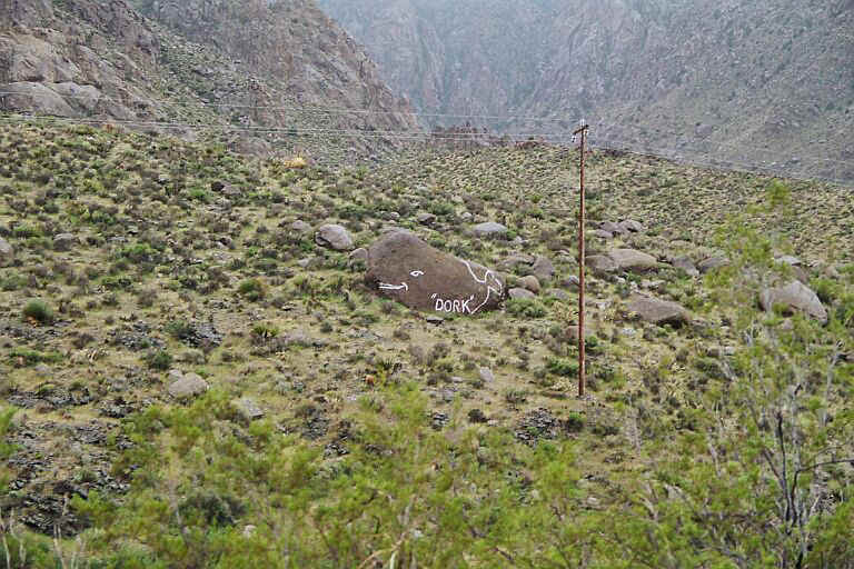
After the road comes down out of the mountains on the north side it becomes a good dirt
road and then it turns back to pavement near the town of Tecopa. We camped in the desert
just northwest of Tecopa.
Saturday 04,03
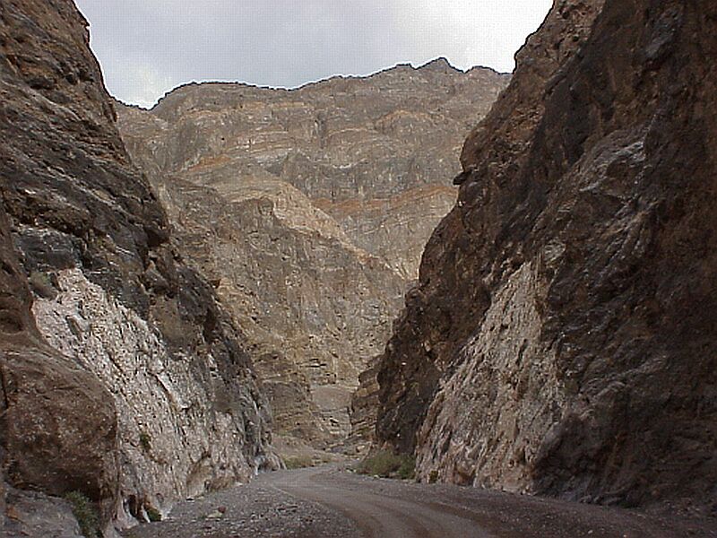
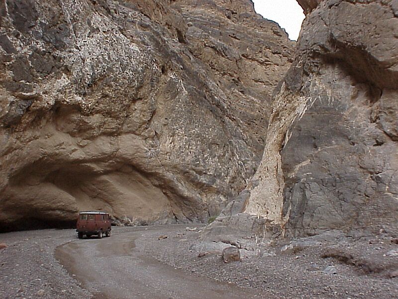
We drove to Beatty, NV where we got gas and then took Highway 374 towards Death Valley. We
turned off 374 onto the Titus Canyon Road. This road is a one way dirt road into the east
side of Death Valley and the drive is spectactular. 
When we got into the valley proper we turned north and drove to Scotties
Castle 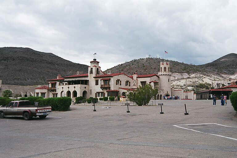 where we took the tour.
When we came out of the Castle, a light rain was falling.
We had lunch at their snack bar and headed east out of Death Valley to Scotties Junction
and Highway 95. Between THe Castle and the junction it was pouring rain.
We turned west on Highway 266 toward Fish Lake Valley, NV 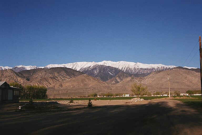 and the town of
Dyer where my cousin Angie and her husband Norman lives.
and the town of
Dyer where my cousin Angie and her husband Norman lives. 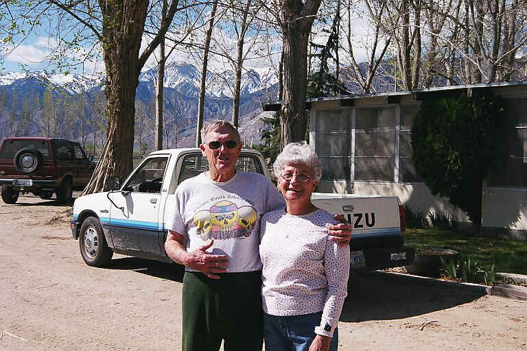 They were very surprised
to see us of course. It had been 20 years since the last time I had visited them. Dyer is
a little off the beaten track you see.
They were very surprised
to see us of course. It had been 20 years since the last time I had visited them. Dyer is
a little off the beaten track you see.
Sunday 04,04
Norman took us on a tour of the valley and to the revived ghost town of Gold Point. 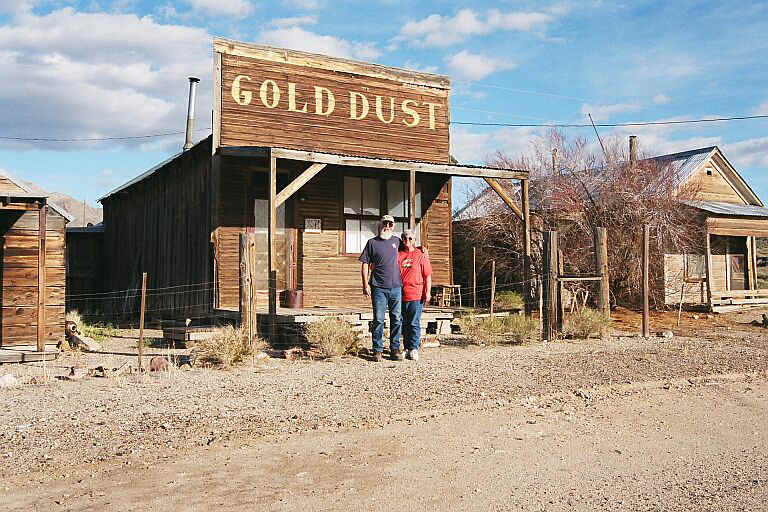 On
the way to Gold point we stopped to see some petroglyphs.
On
the way to Gold point we stopped to see some petroglyphs. 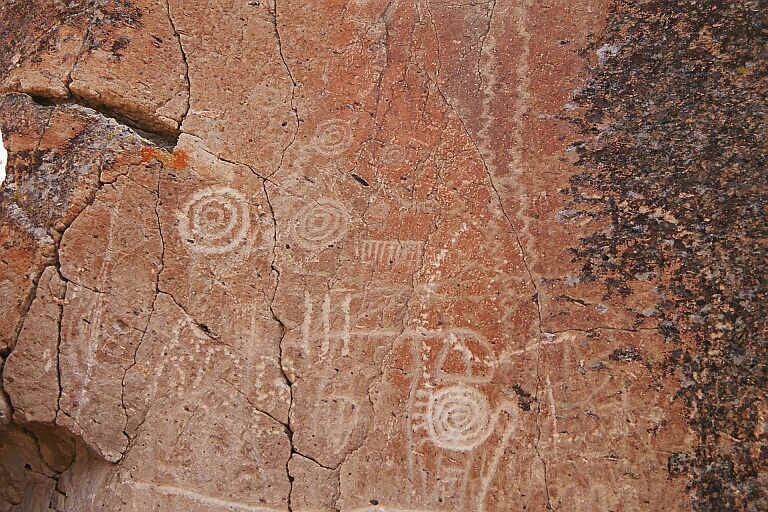
Monday 04,05
Headed out the north end of Fish Lake Valley and caught Highway 6 headed west to Benton,
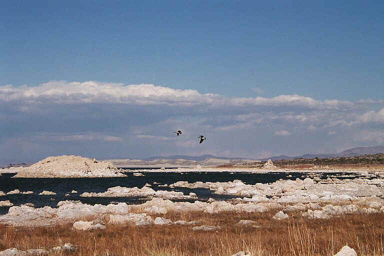
NV where we took Highway120 to Lee Vining. Stopped at Mono Lake for a couple of pictures.
Drove north on 395 to 208 where we turned east and found a place to camp on the side of
the mountain on the west side of Smith Valley.
Tuesday 04,06
We retraced our drive back to 395 and turned north and drove to just south of Carson City
where we picked up Hwy. 50 and turned west to Lake Tahoe and over Eco Summit.
At Placerville we took 49 north and stopped at our friend Kris's in Pilot Hill where we
spent the night.
Wednesday 04,07
Left Kris's around 9:00 and drove up to Nevada City where we took the road to North
Bloomfield. We had planned to go to Mores Flat which is off the Graniteville road.
My dad had a mining claim there back in the 50's and 60's and I hadn't been there in
several years.
We found the turn off to Mores Flat but unfortunately, after just a short distance the
road was drifted over with snow so we turned around and headed for home.
Got back to Santa Rosa around 6:00pm.
Well, we had a great trip and I hope you enjoyed reading about it as much as we did doing
it
Foot