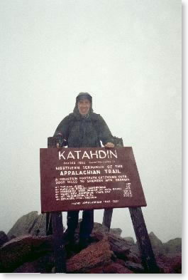
Wednesday, September 4 -- Katahdin Stream Campground to summit of Mt. Katahdin and return -- 5.2 + 5.2 miles
Got to Katahdin Stream Campground at 7 a.m. -- teamed up with Scarecrow, a retired career army officer thru-hiker about my age. Weather was gray and damp, with occasional rain. First two miles were easy; third mile was killer. Joined by three other thru-hikers here. Very ledgy, hard going. Visibility a problem; finally took glasses off. Rain on and off; cloudy, in 60s. Last two miles on tableland were practically flat. Reached summit about 11:30 (Scarecrow had gone on ahead) -- got photos, ate sandwich, and left. Went down very carefully through steep section -- was by myself. Weather was starting to clear; got some views. Took it very easy. Reached bottom at 4:45 -- had a few problems with ledges but made them all. Very impressive mountain (what I saw of it).
|
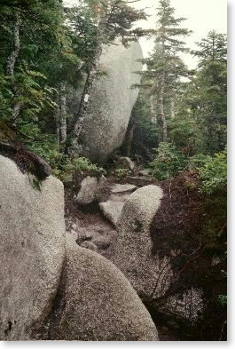
| On the trail up Katahdin |
 |
| The trail gets steep in the third mile |
 |
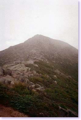
| On the summit of Katahdin |
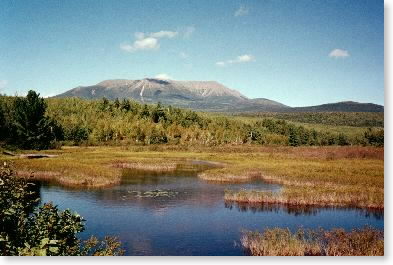 |
| The first time I really saw Katahdin (from near Abol Bridge, the next afternoon) |
Thursday, September 5 -- Katahdin Stream Campground to Hurd Brook Lean-to -- 13.4 miles
Left Katahdin Stream about 9:15. Mostly easy walking through mostly level woods. Windy, cloudy around 60°. Clearing by mid-day. Past Daicey Pond, Niagara Falls, down stream to Penobscot River. Several plank crossings, no fords. Saw several thru-hiker types. Lunch 12 to 12:45. Sunny in the afternoon. Met ranger and talked a bit. Finally got view back to Katahdin, clear. After crossing Penobscot River, entered 100 Mile Wilderness. Up hill and through hemlock boulder garden to Hurd Brook Lean-to about 4:45. Shared with four thru-hikers and two gentlemen from Boston area doing southbound hike through 100 Mile Wilderness. Very pleasant group. Afternoon was very fallish -- brisk, sunny, still warm.
Friday, September 6 -- Hurd Brook Lean-to to Pollywog Stream Bridge -- 13.9 miles
Left Hurd Brook about 8:00 -- nice views from Rainbow Ledge (9:15). Sunny, windy, in 60s. Lots of birch/beech foliage color in this area. Down to Rainbow Lake -- again, lots of color. Passed cutoff to Rainbow Mountain 11:15; lunch by Rainbow Spring Campsite at noon. Ankle feeling sensitive, so watching stride placement carefully. The stretch along Rainbow Lake and interim ponds to Rainbow Lean-to were incredibly rooty. Arrived at lean-to about 3:00 and hung out for a while with the two guys from Boston (from last night), then decided to push on and make tomorrow's miles to White House Landing less absurd. Too bad, as the lean-to was quite nice. Saw moose (large black male w/rack) uphill from stream. Tented by Pollywog Stream bridge near logging road. Heard two cars go by on road all night and a.m. Averaged near two miles/hour despite rooty/rocky trails.
 |
| Entrance to 100 Mile Wilderness |
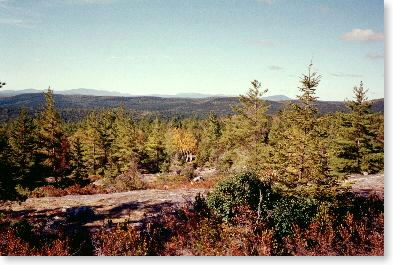 |
| View from Rainbow Ledge |
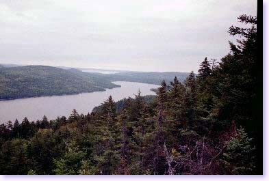 |
| View from Nesabatunt Mountain |
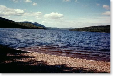 |
| Nahmakanta Lake |
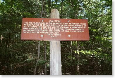
Saturday, September 7 -- Pollywog Stream Bridge to White House Landing -- 13.2 + 1.2 miles
Up early; left about 7:30. Found better campsite upstream. Weather humid and cloudy. Up to viewpoint at Nesuntabunt Mountain past Crescent Pond. There at 9:30. Steep down, then MUDs (mindless ups and downs) to beach at Nahmakanta Lake. Passed Wadleigh Stream Lean-to, complete with smoldering fire, at 11:15 a.m.!! Took a minute and smothered it. Right ankle feeling better, though one false plant really hurt. Had lunch by Nahmakanta Lake at noon. Couldn't find multitool. Long frustrating afternoon -- got tireder and tireder. Saw small black animal by stream -- 12-18", black, very nimble -- turns out to have been a mink. At end of lake about 2:00, finally to White House Landing pickup spot about 5:00. Was just beat. White House Landing is a camp on Lake Pemadumcook that has gotten into the business of accomodating hikers. A nice spot, very hospitable. Had shower, pizza and beer for dinner, and repacked food bag.
Sunday, September 8 -- White House Landing to Cooper Brook Falls Lean-to -- 14.0 + 0.3 miles
Finally left White House Landing after 8 a.m. breakfast and after finding everything that I lost or misplaced the night before. (Given how early hikers start on the trail, it was strange the hikers' breakfast wasn't earlier.) On trail about 9:45. Passed Pataywajo Spring Lean-to about 11:00. Huge spring -- easily 6' in diameter. Lunch 12:30-1:15 near Antlers Campsite next to Jo-Mary Lake. Weather partly sunny, hot (in 80s) humid. Watered up at Antlers Campsite and left about 1:45. Arrived at Cooper Brook Falls Lean-to about 5:45 after usual long grinding afternoon. Trails were easier, for a pleasant change -- lots of old woods road walking. Weather a little more sunny and pleasant in the afternoon. Walked near two young guys from Massachusetts whom I had met at White House Landing, one of whom turned around. (The other, whose trail name was OB, I would see again and again as I headed south.) Cooper Brook Lean-to was full, so I tented nearby. Was next to thru-hiker Dutch Uncle, who along with thru-hiker Gear Girl greatly admired my Wanderlust tent.
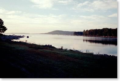
Lake Pemadumcook just after dawn