Saturday, September 14 -- Maine 15 near Monson to confluence of west branch of Piscataquis River and Bald Mountain Stream -- 12.1 miles (no camera for next three days)
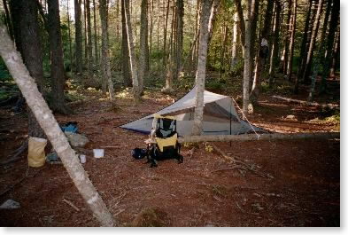
Left Rt. 15 about 9:15. Easy going during a.m. over relatively benign terrain. 45 minute lunch past Lake Hebron. Saw Flame, the first thru-hiker I had talked to at Madison Springs Hut on Aug. 26, and her traveling companions. Weather partly sunny and cool, with temperature in the 60s. Nice day for hiking -- feet felt outstanding -- no problem with socks. Arrived at Horseshoe Canyon lean-to about 2:45 and decided to push on to be better positioned for ascent of Moxie Bald Mtn. tomorrow. Followed Piscataquis River canyon, with lots of PUDs (pointless ups and downs) along the trail. Down to river, up again, down to river, up again.... Arrived at confluence of west branch of Piscataquis River and Bald Mountain Stream about 4:45, and tented next to river. Open, buggy, breezy site. Started raining about 10 p.m. and rained through the night.
Sunday, September 15 -- Confluence of west branch of Piscataquis River and Bald Mountain Stream to Bald Mountain Brook Lean-to -- 9.9 miles
Got up and everything was wet. Fortunately the rain stopped about the time I got up and stayed stopped until after I started (7:40). After a while the rain picked up and was steady and hard. Some good trail in a.m., some not so good. Got to Moxie Bald Shelter about 10:45 and had early lunch with four other people (two south-bound -- a couple). [After-note: this was my first meeting with Cougar Bon Bon and Idaho Joe, with whom the rest of my hike would be intertwined.] Left about noon and went up Moxie Bald. A bit of sun on the way up, then mist. Saw family of spruce grouse on summit. Weird environment -- summit area burned over. Lightning or human? Went down to Bald Mountain Brook Lean-to -- stopped early (about 3:00). Same south-bound hikers showed up. Also northbound thru-hikers Choo Choo (from Chattanooga) and Peace Warrior. More rain in p.m.
Monday, September 16 -- Bald Mountain Brook Lean-to to U.S. 201 near Caratunk -- 15.0 + 0.1 miles
Up and pushed off early (by 7:15) -- still light rain, but temperature was in 60s, so chill not a problem. Up Pleasant Mountain, over numerous summits, finally to peak for lunch about 12:15. Had heard terrifying report from northbound hikers about slick steep ledges on west side of Pleasant Mountain. They were indeed steep, and slick to a degree, but manageable. I made it down OK except for getting one of my feet stuck in a root on a steep slope. To Pleasant Pond intersection about 1:30 -- didn't bother to visit lean-to. Walk through uninteresting hardwoods to U.S. 201 north of Caratunk. Weather just cloudy in afternoon, in 60s. Feeling better with longer distance. Boots a sodden mess as a result of the rain. Second pole grip torn 9/15.
Tuesday, September 17 -- zero mile day -- at motel in Farmington
(lost day to schedule here -- should not have scheduled two long days back to back -- needed to allow time to go to and from motel, pack, set up food, resupply, take shower, etc. Was able to get food batches together for all the way to Pinkham Notch.)
Wednesday, September 18 -- U.S. 201 near Caratunk to west side of East Carry Pond -- 9.9 miles
Left road in Caratunk about 10:00 after comedy of errors (left wallet at motel, missed turnoff) -- ferried across Kennebec by somewhat surly ferryman who was quick to tell me he was a thru-hiker. Very nice day -- bright sun, comfortable temperature. All the light (which hit trees in mottled fashion through branches) and somewhat random blazing made it hard to follow trail. Trail followed brook up -- attractive waterfalls etc. Lunch at Pierce Pond Lean-to -- very attractive location. Afternoon was mostly slog through boring second growth on decent to good trails. Did not want to push for West Carry Pond Lean-to so I tented on west side of East Carry Pond. Pretty spot in spruce groves. Warched moon rise, reflection on lake, listened to loon calls. Cool evening -- in high 30s.
|
| Campsite near East Carry Pond |
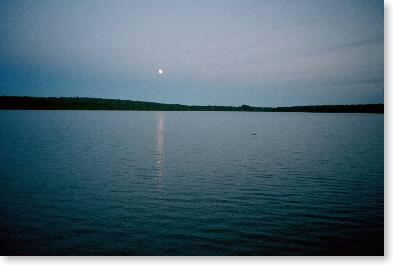 |
| Moonrise over pond |
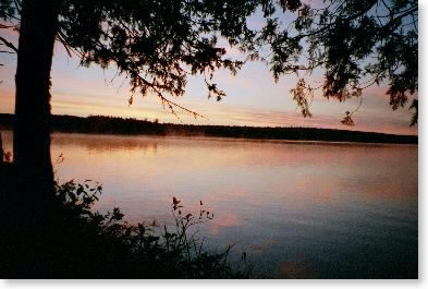 |
| Sunrise over pond the next morning |
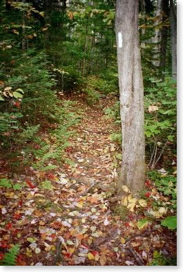 |
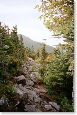
| Trail |
Thursday, September 19 -- West side of East Carry Pond to Little Bigelow Lean-to -- 11.1 + 0.1 miles
Awoke to beautiful sunrise over lake, with pink sky and mist rising off the lake. Left at 7:45, hiked through unspectacular woods to West Carry Pond Lean-to shortly after 9:45. Up through hardwood forest; stopped for lunch just before Long Falls Dam -- 11:45 to 12:30. Leisurely hike up to Little Bigelow Lean-to -- very nice view and very nice spring. Weather was nice and warmed up considerably in the afternoon -- up to near 80°. Feeling soreness in left ankle -- guess I really jammed it when I stuffed it in the roots coming down off Pleasant Mountain.
Friday, September 20 -- Little Bigelow Lean-to to Horns Pond Lean-to -- 10.2 + 0.1 miles
Woke up to strange weather -- windy, warm, cloudy. Shelter privy was two-seater. Got off about 7:15. Seriously bent one of my poles in first half hour in fall. Up Little Bigelow Mountain. Went over several summits, then down to junction with side trail to Safford Tentsite about 10:30. Started up Avery Peak -- stopped for lunch 11:15 to noon. Steep and rocky -- managing OK with one pole. At summit about 1 p.m. Windy, visibility about 10 miles, no one else there. Rested a bit then hiked down to Avery Tentsite -- watered up and left for Horns Pond Lean-to about 2:00. Occasional sun in afternoon. Down to Horns Pond. All alone in shelter -- saw my only mouse of the trip here, and he was a voracious one -- went right for the snack bag in my pack. Noticed one boot starting to delaminate.
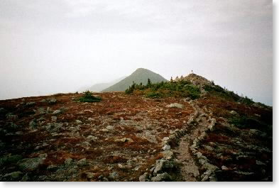
 |
| Looking ahead to Avery Peak from Little Bigelow Mountain |
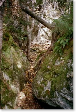 |
| Notch |
 |
| Trail up Avery |
 |
| Near summit of Avery Peak |
Saturday, September 21 -- Horns Pond Lean-to to Maine 27 near Stratton -- 5.1 miles
Left about 8:00. Misty morning clearing to sunny and warm (in 80s). Up and level and then down down down. Not steep but steady. Saw lots of Saturday hikers coming up. Through the usual forest levels -- grew hotter and hotter. Not much color in the woods but more apparent from looking at the big picture. Out about 11:30. Off trail in Farmington that night. Was able to find replacement Leki poles in Farmington -- huge! Actually ended up with a much better pole.
Email sent to my mailing list on Sept. 21
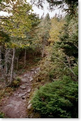
 |
| typical rough Maine trail |
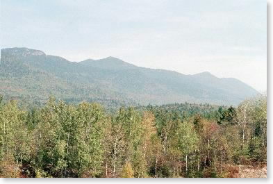 |
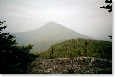
| Bigelow Mountain (left to right: South Horn, West Peak, Avery Peak) |