Sunday, October 6 -- Gentian Pond Shelter to U.S. 2 near Gorham -- 11.8 miles
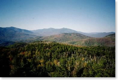
Up at 5:30 to get early start. Off just after 7:00. Fair and clear; not too cold. An early climb, but overall the trail was noticeably easier than yesterday. Beautiful view of Presidential Range from Wocket Ledge. Three hours to Trident Col Campsite; lunch on Cascade Mountain. Grinding climb up Mt. Hayes, then long downhill to Rt. 2. Trail good all the way. Dry woods on faces; feet hurting near end. Out by 2:30. At Hiker's Paradise in Gorham for evening. Cousin Terry (Paul Rogers) showed up later to hike with me for the next three days; went out for Chinese with him and Bigfoot. Foliage near peak -- got some nice photos. Mood better today with easier walking, more reasonable trails.
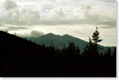
|
| Mt. Washington from Wocket Ledge |
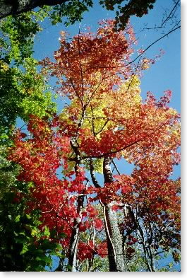 |
| Foliage |
Monday, October 7 -- U.S. 2 near Gorham to Imp Shelter -- 8.0 + 0.2 miles
After early-morning running around in Gorham to get gear and food, left U.S. 2 about 9:15. Gray day; not too cool. Stopped at Rattle River Shelter for about 45 minutes for Terry to make adjustments to his pack. First couple of miles easy uphill on excellent trail, then it got steeper and rougher. Stopped for 1/2 hour gourmet lunch (salmon, bread, cheese). Up on top of Mt. Moriah in very light rain about 2:30. Cloudy and no view. Began to clear later, and had nice southerly views from ledges coming off Moriah. Brief up and down to Imp Shelter at 4:30. Took hardest fall of trip to date [afternote: of entire trip] coming into Imp Shelter. Got feet jammed in crack together coming down a ledge and pitched forward -- hit side of trail and rolled, ending up with pack on top. Abrasions on knee and butt, but got up and walked away. Lucky. Gourmet dinner at shelter: chicken, fresh salad and carrots. In 40s, clearing, windy. Nice view NW from bench 50 feet or so in front of shelter. Saw no other hikers today.
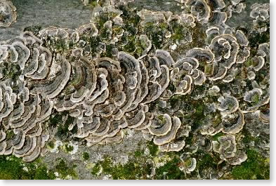 |
| Fungus on tree |
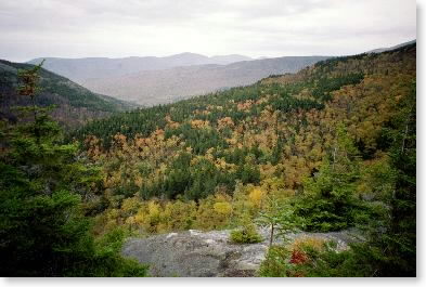 |
| Foliage from Mt. Moriah |
 |
| Sunset from bench below Imp Shelter |
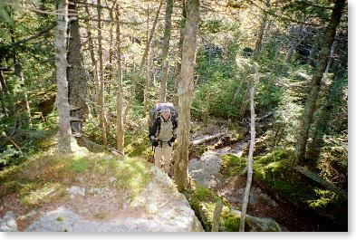 |
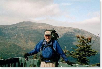
| Cousin Terry on the trail |
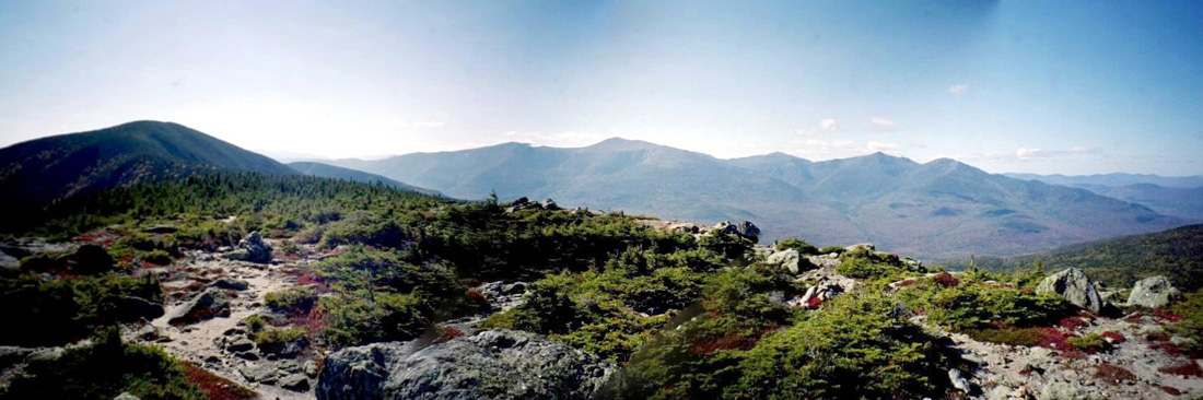 |
| Presidential Range panorama from Mt. Hight; Carter Dome down the ridgeline to the left |
Tuesday, October 8 -- Imp Shelter to Carter Notch Hut -- 7.2 + 0.3 miles
Cooled down to freezing -- still sunny and windy. Cooked breakfast inside shelter; off at 8:30. Some ice on rocks up on ridge as we went up to North Carter. Just barely above freezing along ridge on top, although comfortable in the sun (was OK with long-sleeved poly and shell). Wind chill near zero (Terry had device for measuring). Excellent views -- saw Sebago Lake and the Atlantic Ocean in Maine to the east. Lunch at sunny spot -- again cushy. Saw two peak-baggers out for the day. Up in p.m. to Mount Hight -- beautiful views all around. Very steep but non-ledgy descent to Carter Notch Hut. Beat hell out of knees -- trail was well constructed, so it was like walking down a very steep staircase. Terry having serious knee problems. Only saw four hikers on the trail all day. Nice hut, do-it-yourself kitchen. Headed below freezing again. Vivid foliage.
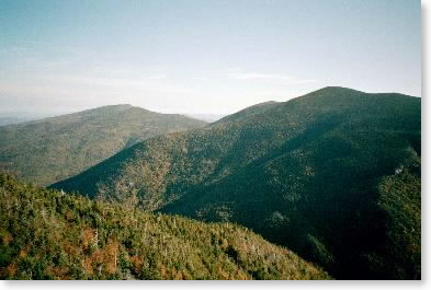 |
| Looking north to Moriah and Carter from Wildcat "A" |
 |
| Snowbird on Wildcat, with Mt. Washington across the valley |
Wednesday, October 9 -- Carter Notch Hut to New Hampshire 16 at Pinkham Notch -- 5.9 + 0.1 miles
Cold -- 28º at hut. Mostly clear. Off about 8:30. Terry went down Nineteen Mile Brook trail to NH 16 to spare his knees. Up steep slope out of notch; ridgewalk for a while; views good but random (no open until summit of Wildcat gondola. Weather cold (in 30s) and clouding up. Lunch for 1/2 hour in sunny spot on trail shortly after I passed Wildcat gondola. Steep down in afternoon. Some ledges with steps; good stepping for the most part. Last mile at bottom was level but was a mixture of the worst and best of the trail. Reached Pinkham Notch at 2:30. Terry was already there, with Pam and Marty. Pack weight 32 pounds according to hanging scale at trailhead. Got bent section of pole replaced. Went off trail; drove to White River Junction to get set up there.
Thursday, October 10 -- zero mile day
Spent the day off the trail in White River Junction getting organized for the next sections of the hike. Since I had already completed the Pinkham Notch-Franconia Notch section in late August (and this turned out to have been an excellent idea), my next jumping-off point would be Franconia Notch.