Friday, October 11 -- Franconia Notch to Kinsman Pond Hut -- 4.8 + 0.6 miles
Left Flume parking lot shortly after 1:00. Hiked Pemi Trail 0.5 miles back to AT and crossed under highway. Weather gray; woods damp, temperature 50º. No showers during the afternoon. Easy ascent for a while, then the usual rocks and roots along the stretch to Lonesome Lake Hut. Back pad irritatingly hard against back -- don't know why [Afternote: it was because I had lost so much weight that bits of bone were beginning to surface.] Passed Lonesome Lake Hut shortly after 3:00. After flattish stretch, ascent became steep. Some ledges, well conditioned with steps. Up to Kinsman Pond Shelter -- arrived about 5:15. No one else at shelter, though there were a couple of couples tenting nearby. Wind off pond. Not many other hikers on trail -- some descending without gear; some around hut.
[Afternote: in my original plan, I planned to go to Eliza Brook Shelter today, but I would have needed a full day, and since it was the peak of the foliage season, we could not find a room in the area so that I could spend the night in N. Woodstock or Lincoln and get an early start. As a result, I lost a day against my schedule.]
|
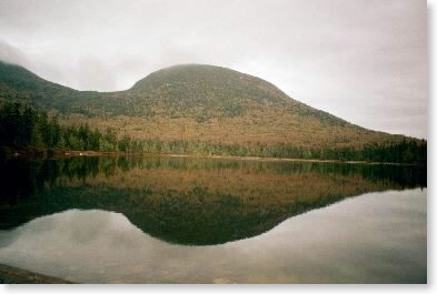
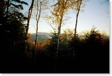
| Lonesome Lake |
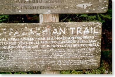 |
| AT sign at Lonesome Lake |
Saturday, October 12 -- Kinsman Pond Hut to Eliza Brook Shelter -- 4.0 + 0.1 miles
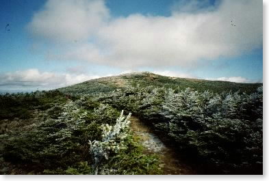
Windy with some rain during the night. Up leisurely and off at 8:45. Up North Kinsman -- weather overcast, 40º, with some signs of clearing. Could see Franconia Range across the valley, with some cloud cover. To summit of South Kinsman about 10:00. Downslope of South Kinsman had plenty of ledges, but only a few required descent on butt (some very steep ledges which the trail used to descend appeared to have been bypassed for easier routes). Lunch on trail near Harrington Pond (1/2 hour). Descended near/next to Eliza Brook for a mile to Eliza Brook Shelter just after 1:00. Clearing later with sun coming through and cool. Found Giants/St. Louis National League championship game on the radio and listened to the Giants lose, 5-4. Shared shelter area with scouts from Mass. Good group.
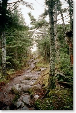 |
| Trail on Kinsman Mountain |
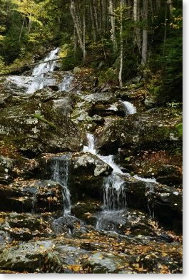 |
| Beaver Brook cascade |
Sunday, October 13 -- Eliza Brook Shelter to Beaver Brook Shelter -- 9.1 miles
Up early and off at 8:00. Cloudy with evidence of rain at higher elevations. First hour fast, second and third hours slower as elevation up, more and more ledges etc. etc. Over summits and ridge of Mt. Wolf to junction with Gordon Pond Trail about 11:30. Was OK early, but started having problem with back of belt pinching. Also pain in right hip (pinched nerve??). Stopped for quick lunch and hauled ass for Kinsman Notch. Arrived there about 2:00 after not-so-steep down into notch. Some rain about this time. Up beautiful, steep, and very wet Beaver Brook Trail. Generally well engineered -- several ledges with steps into stone. Very wet but not too slippery. Arrived at Beaver Brook Shelter after 4:00. Very crowded -- lucky there was room for one more (there wasn't really but I squeezed in). Some heavy rain followed by high winds as cold front went through.
 |
| View from Beaver Brook Shelter in a.m. (frozen boots and water bottles not shown) |
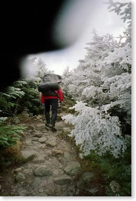 |
| Heading up Moosilauke: trees with rime ice |
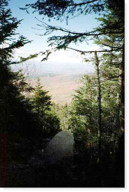
Monday, October 14 -- Beaver Brook Shelter to Jeffers Brook Shelter -- 6.8 + 0.1 miles
Cooled off during night. About 25º at 6 a.m. Lots of wind during the night. Clear at sunrise, with nice view toward Franconia Range. Water bottle and boots were frozen. Up early, ate breakfast, and let all the other shelter occupants leave. Up Moosilauke with three guys from Maine. Left shelter about 9:30; at summit shortly after 11:00. Summit was socked in as we were going up, but cleared as we got there. Rime ice on trees and grass last 500 vertical feet. Very windy and about 20º at top. Windchill roughly -20º. Comfortable with shell layers and Marmot outer top, long johns and rain pants. Beautiful views, although rushed. Several other people on summit. Down to junction near south peak -- had lunch 12-12:30. Down by 2:30; at Jeffers Shelter by 3:00. Very pretty location. Panoramic backlit view from shelter. Cool evening. All alone.
[Afternote: I lost another day here against original schedule -- my original plan was to go from Beaver Brook Shelter to Ore Hill Shelter in one day. Probably unrealistic given rendezvous planned for Glencliff, and given the distance. Maybe in the summer I could have done it with an early start and a long day to walk in.]
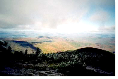 |
| View from Moosilauke summit |
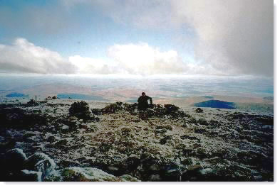 |
| Snowbird on Moosilauke |
 |
| Looking back up to Moosilauke summit |
 |
| Looking down from Moosilauke at the fall foliage |
 |
| View from Jeffers Brook Shelter |
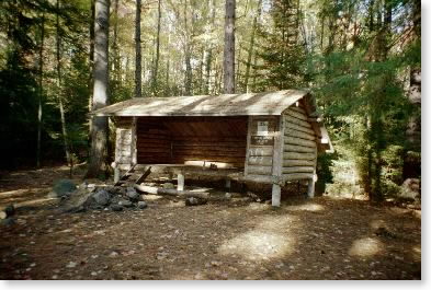 |
| Jeffers Brook Shelter |