
Tuesday, October 15 -- Jeffers Brook Shelter to Ore Hill Shelter -- 8.5 + 0.1 miles
Up at 6:15. Off at 8:00. Very strange privy floor plan. Sunny and cool -- in mid 20s. Hiked one mile to route 25, waited, Pam showed up, we did resupply. Started hiking again about 10:00. Beautiful sunny day with foliage showing off. Up over one hill, past pond, up Mt. Mist (lunch near summit). Marvelous trend of late yesterday -- easily walkable trails -- continued nearly all day today. Made well over 2 mph in first hour after lunch. Crossed route 25C at 1:30 and arrived at Ore Hill Shelter a little after 3:00. Temperature never above high 40s. Still having problem with pain against hip pad. Trail starting to get lonely -- haven't seen any southbounders since Franconia Notch. Very few people on trail. Privy with drawbridge door and shelter with oil painting on the wall.
|
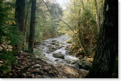
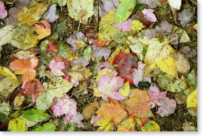
| Leaf shot |
 |
| Leaf shot |
Wednesday, October 16 -- Ore Hill Shelter to Hexacuba Shelter -- 7.3 + 0.3 miles
Up at 6:15 and off at 7:45. Gray, 40º, looks like rain. To route 25A by 9:00, then up Mt. Cube. Rain started about 10:00. At summit by 11:00. Rainy, windy, and altogether unpleasant. Pushed on for lunch at Hexacuba Shelter. Got there about noon (pretty amazing time given ledges, rain, etc.). Hands were freezing; jacket wasn't up to cold rain, so I decided not to push on. Risk of hypothermia would have been huge in case of injury/accident. [Afternote: lost another day to schedule as a result, as day after tomorrow would end up being a short day as a result.] Need my North Face Mountain Jacket, for one thing. One hiker came in for lunch with his dog; we had nice chat. Then who should come in but OB? Then a couple headed south. Finally had to change flashlight batteries - first time in entire trip. Continued bizarre features of shelter and privy. Shelter was six-sided, and privy was five-sided (not true pentagon -- shaped more like a home plate).
Thursday, October 17 -- Hexacuba Shelter to Trapper John Shelter -- 12.0 + 0.6 miles
Up early and on trail by 8:30. Rain had stopped, but still cool. Out to Eastman Ledges; called Pam and set rendezvous for afternoon for jacket and extra food. Down to brook, then long steady uphill to peak of Smarts Mountain. Lots of damage to forest, especially above 2000 feet; apparently from icestorm a few years ago. Got to firewarden's cabin for lunch shortly after 11:30 with couple from last night there. Long descent over endless series of ledges (Lambert Ridge) to Lyme-Dorchester road about 2:40. One hour over two "easy" miles (fell twice) to rendezvous with Pam. Reviewed route ahead and realized I wasn't going to be able to do all of the Vermont miles before we had to leave to be in Albany the morning of the 23rd. Darn. Then 1/2 hour up to Trapper John Shelter. Another DOC wierdo: there was a freestanding stone fireplace about 20 feet in front of shelter and facing it. Punctured air mattress, and ended up, despite best efforts, sleeping on the floor.
 |
| South Jacobs Brook |
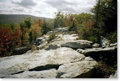 |
| Lambert Ridge ledge |
Friday, October 18 -- Trapper John Shelter to Moose Mountain Shelter -- 5.9 + 0.6 miles
Struggled with air mattress all night. Rain during evening, pretty much stopped by dawn. Privy in a.m. was also bizarre: no roof, armchair above privy seat. Cool (40º). Up, over, and down Holt's Ledge, then long gradual climb up Moose Mountain. Stop 3/4 of an hour for lunch. Afternoon ridge walk on Moose Mountain -- some viewpoints along the way. Continued good trail. Partly sunny but mostly gray skies. In 40s all day. Down to Moose Mountain Shelter (old and decrepit) about 2:00. Only shelter on trip that needed to be torn down.
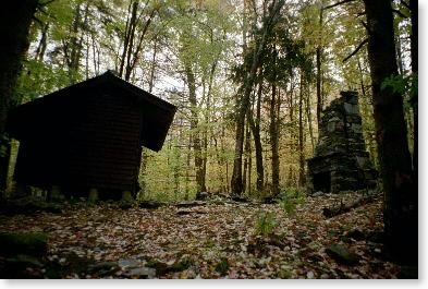 |
| Trapper John Shelter, with fireplace |
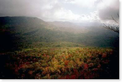 |
| Landscape near Hanover |
Saturday, October 19 -- Moose Mountain Shelter to Connecticut River -- 11.3 + 0.3 miles
Up promptly and off at 7:45. Gray, around 40º, about to rain. Rained for a while on south summit of Moose Mountain. Never really amounted to much; gave up on mountain jacket and went back to shell. A variety of walking: dirt roads, fields, woods, most of it easy. Near Etna-Hanover Road in two hours. Lunch at 11:45-12:15 on way up Velvet Rocks -- cut finger while slicing cheese. Over Velvet Rocks and emerged from woods right by the Hanover Coop shortly after 1:00. (This is a great resource for hikers coming through Hanover.) Walked through downtown Hanover (passing right by Dartmouth football stadium with game in progress) and crossed Connecticut River close to 2:00. Pam picked me up in rain under I-91 bridge.
email sent to mailing list Oct. 19
 |
| Another leaf shot |
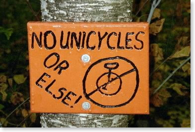 |
| Dartmouth Outing Club signage |