Sunday, October 20 -- Connecticut River near Hanover to Vt. 14 near West Hartford -- 9.3 + 0.2 miles
Slackpacked today. Nice to get heavy pack off back. Mostly undistinguished but pleasant woods walking once through Norwich and up into woods. Saw few people; the ones I did see reminded me I should have been wearing blaze orange as it was bow-and-arrow deer season. Weather fair/partly cloudy, temperature in 40s (just missed brief shower before I started). Started about 11:10; stopped at power line for lunch at noon (2.6 miles uphill in 50 minutes, largely road walking out of Norwich). Also stopped at Happy Hill Shelter and saw entry by Cougar Bon Bon commenting on how nice the trail was. It was nice, and possible to move quickly. Blazing not always on the ball. Got nice and sunny later in day. Crossed under I-89 and finished shortly after 3:00. (No camera today.)
[Afternote: a definition would be useful here. Slackpacking is essentially dayhiking. Instead of carrying everything on your back (including food and sleeping gear) and hiking from point to point on the trail, when you slackpack you hike from one road crossing to another, eat dinner, sleep, and eat breakfast off the trail, and carry only a day pack. My email of Oct. 30 discusses slackpacking at greater length.]
Monday, October 21 -- Vt. 14 near West Hartford to Barnard-Woodstock Stage Road, Pomfret -- 11.1 + 0.2 miles
Also slackpacked today. Drove out from White River Junction, left Vt. 14 at 9:00. Long fairly easy uphill in a.m. out of White River valley. Some good views, but weather was gray. Mostly woods walking, but trail crossed some fields. Saw one distance hiker headed north. Got to Thistle Hill Shelter about 11:30. Very nice shelter; had six-sided "phone booth" privy (lower panels not clear; upper panels open). More woods walking after lunch, then passed Cloudland Farm, with fields with beautifully colored trees. Mixed sun and clouds now, with temperature in 40s, and very nice foliage. [Afternote: the foliage was late this year -- most years the leaves would be pretty much gone in this part of New England by Oct. 15.] Got lost going over ridge from Bartlett Brook in Pomfret. Lost footpath in leaves coming down backside of ridge and didn't see blazes go through trees. Found way down to valley road which trail crossed, went wrong way on road following what looked liked blazes, and then went down the road and picked up the trail. Out at Barnard-Woodstock Stage Road, Pomfret -- had hoped to go as far as Vt. 12, but it was getting late.
[Afternote: original hike plan had been to go all the way to the Maine Junction near Killington and then jump down to Massachusetts just south of the Vt./Mass. state line, skipping over about 106 miles I had hiked before in the 1970s. Ended up leaving 23 miles undone here.]
|
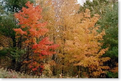
| Foliage |
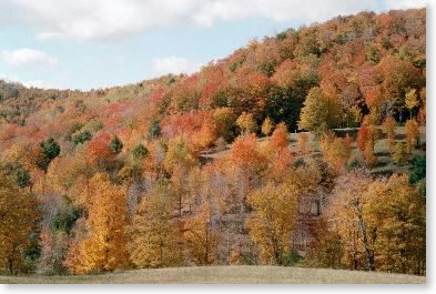 |
| Hillside near Cloudland Farm |
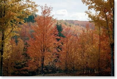 |
| Foliage |
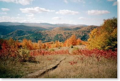 |
| View from ridge above Pomfret-South Pomfret Road |
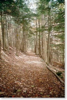 |
| Woods walk |
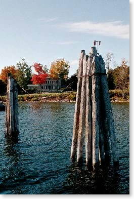 |
| From Lake Champlain ferry |
Tuesday, October 22 -- Zero mile day
Drove from White River Junction up to Shelburne (near Burlington), Vermont, to visit Shelburne Museum, and then across Lake Champlain on a ferry and down to Albany to airport.