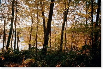
Wednesday, October 23 -- Pine Cobble Trail cutoff to Mass. 2 near North Adams -- 2.8 + 2.8 miles
After dropping Pam off at the Albany airport and checking into our short-term apartment rental near Lee, I drove up to Mass. 2 in North Adams. Today's hike would be a round trip from Mass. 2 north to the Pine Cobble Trail cutoff near the Vermont state line, where I had left the AT when I had hiked the southern Vermont miles in the 1970s, and back down to Mass. 2. The weather was cold -- just above freezing -- and there had been snow earlier in the day, with some still on the ground. Started at 12 noon. Trail was uphill (though not steep), rocky, slippery, with some patches of snow (also lots of mountain laurel). Made it up to the junction with the Pine Cobble Trail in 1-1/2 hours. Rocky stretch near the top was slow and slippery. Occasional brief rain but also some sun. On the way down, was overtaken by southbound hiker Mario -- met him again at the bottom and gave him a ride to Williamstown. Total hike was three hours.
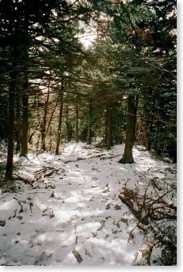
|
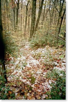
| Snow in woods Oct. 23 |
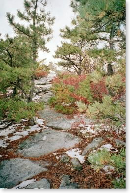 |
| Snow on rocks near Pine Cobble Trail cutoff |
Friday, October 25 (out-of-order dates are correct) -- Mass. 2 near North Adams to Mass. 8 near Cheshire -- 14.0 miles
More slackpacking. Up at 5:30, dropped car at gas station just south of Mass. 8 trail crossing at 7:10 (roughly dawn). Hitchhiked north through North Adams to Mass. 2 trailhead. Took three rides plus a mile of walking (1-1/2 hours total) to get to the trail crossing at Mass. 2. Got to the trail at 8:40. Long gradual uphill on road, then steeper in woods. Into snow; grade more gradual. Some ice near the top. At summit of Greylock around 12:15-1:00 for lunch. Fair, cool, in 30s (40s later in day). Views were pretty good -- could see Monadnock in New Hampshire plus the major southern Vermont peaks. Saw no one else on trail in a.m.; saw a few other folks at summit and after lunch in woods near the summit. After-lunch stretch along Saddleball was quite snowy and icy, although once I descended a bit, the snow disappeared quickly on the south-facing slopes. Some very steep but mostly gradual down. Long and tiring. Back at Mass. 8 at 4:45 after traversing several fields and low-altitude forests. Still a fair amount of color at lower altitudes.
 |
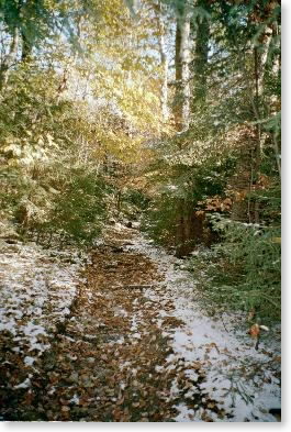
| Leaf shot |
 |
| Trail up Greylock |
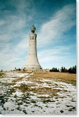 |
| Monument at summit of Mt. Greylock |
 |
| Snow in woods on Saddleball |
Thursday, October 24 -- Mass. 8 near Cheshire to Mass. 9 in Dalton -- 9.3 miles
Another slackpack day. Cold and clear morning; left car at junction of Route 8 and Route 9 and hitchhiked north to trail crossing on Route 8 in Cheshire. Got onto trail at Route 8 about 9:45. Across field, up road, then up through woods to cobbles (open ledges) with good views of valley and across to Mt. Greylock. Pretty much flat to mild-slope woods walking all day along 2000-foot-elevation plateau. Still some snow here and there. Saw a group of about ten when I was stopped for lunch; otherwise, no one all day. Temperature never above 40º. Blazing excellent; just enough to be interesting. One pond and a couple of brooks; otherwise pretty dry. Coming down into Dalton, the last mile or so was a city street pavement/sidewalk. Very slow hitchhiking out of Dalton. Finally got ride back to car from the manager of the local branch of Eastern Mountain Sports.
[Afternote: my impression is that hitchhiking is not as easy as it used to be back in the '60s and '70s. The people who picked me up today and tomorrow (the day above) all had some connection with hiking/backpacking. No one else stopped. And I was carrying a rucksack and trekking poles -- no big backpack.]
Saturday, October 26 -- zero mile day
Rainy and cold. Wimped out and took the day off; stayed home; pigged out and had huge roast beef dinner, then watched the Giants lose game six.
Sunday, October 27 -- Mass. 9 in Dalton to October Mountain Lean-to -- 11.8 miles
Back to hiking with a full pack for three days. Took cab to Dalton; on trail at 8:30. Through village, across railroad tracks, and up over mountain. Mostly unremarkable woods walking in morning. Gray skies; temperature still cold, in 40s. Up over Warner Mountain, with some views. More flat/boggy terrain after lunch (1/2 hour). Also rougher trail -- more rocks and roots. Still mostly very flat. Saw raccoon on break. Into October Mountain Lean-to about 3:00. Saw Cougar Bon Bon and Idaho Joe had been in earlier today. Nice shelter: bunks, picnic table, no fire ring, wires for hanging food. Joined by two other hikers, one in shelter with me. Listened to Giants lose seventh game -- based on where they were in August, it's amazing they made it to the seventh game of the Series.
Monday, October 28 -- October Mountain Lean-to to Upper Goose Pond Cabin -- 8.8 + 0.5 miles
Up at 6:30; off at 8:00. Weather unchanged: gray and in 40s. Trail not as wet as yesterday but definitely rockier (and slower). To Finerty Pond in 2+ hours. Again, mostly unremarkable woods walking -- no views, some wet trail/bogs. Stopped for 1/2 hour lunch in woods just short of U.S. 20 and Mass Pike crossing. Crossed Mass Pike on the trail's own pedestrian bridge, then up and over ridge and out side trail to Upper Goose Pond Cabin. Arrived about 2:00 (though exact elapsed time on trail questionable since I fell asleep on break after lunch). Cabin locked up but is well situated with views of both Goose ponds. Could have pitched tent, but chose to roll out sleeping bag on cabin porch under overhang. Occasional glimmers of sun in late p.m. Geese honking on pond throughout evening. Saw no one else on trail today. Note from Cougar Bon Bon re squiggly Mass. trails in shelter register.
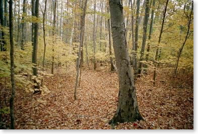 |
| Typical Massachusetts woods (on typical Massachusetts gray day) |
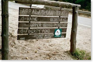 |
| AT sign at U.S. 20 |
Tuesday, October 29 -- Upper Goose Pond Cabin to Tyringham Road -- 7.0 + 0.5 miles
Up about 6:00 to sunrise (time had changed to standard time over weekend -- no more 7:00 sunrises). Off about 7:30 after taking some photos of the sunrise over the pond. Sunny and cool -- below freezing at dawn, though not a hard frost -- warmed to mid 40s. More pleasant woods walking around Upper Goose Pond, past other ponds and bog areas. Knee Deep Pond at 10:00, Webster Road at 10:15 (break), over Baldy Mountain and down to Tyringham. Started having hip pains again-- pinched nerve? Trail relatively rocky. Down hill through hemlocks; out at Tyringham Road at 11:50 after 20 minute lunch. (7-1/2 miles in four hours) Got ride back to apartment from Robert the property manager there. Again saw no one else on trail all day. In afternoon, got beard cut for the first time (changed from Santa Claus to college professor look), then went over to Albany to pick up Pam.
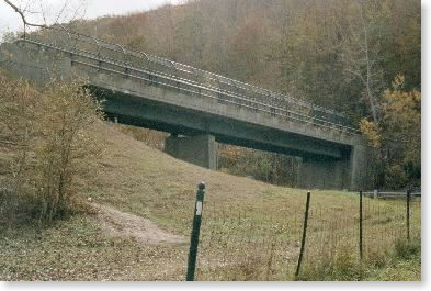 |
| Trail bridge across Mass Pike |
 |
| Sunrise over Upper Goose Pond |
Wednesday, October 30 -- Tyringham Road to Mass. 23 near Monterey -- 12.1 miles
Back to slackpacking. Left Tyringham Road about 9:20. Circuitous route through valley plains, up over cobble, down again, then steep up. Into attractive rocky high country -- still a good bit of foliage -- getting into oaks, which still have color. Lots of woods walking. Lunch at 11:10-11:35 at Beartown Mountain Road. More open woods walking. Missed both Mt. Wilcox lean-tos. Weather gray, in 30s. Interesting ledges in afternoon. Trail really does meander here in Massachusetts. Out at Mass. 23 about 3:30. Trail mostly good, although there were some rocks and steep steps in the afternoon. Saw no one else on the trail for the third straight day.
Email sent to my mailing list on Oct. 30
Thursday, October 31 -- Mass. 23 near Monterey to U.S. 7 near Sheffield -- 8.4 miles
Slackpacked again today. Had to check Pam out of apartment in Lee and into motel in Great Barrington for a couple of days. Got that all taken care of and was onto trail by 11:15. Very nice day -- sunny and in 40s. Up East Mountain to rocky gulch area. Supposed to be shelter here, but I never found it (signage issue? signs yesterday and today invisible to southbounders? I don't know). Stopped for lunch in woods. Afternoon started with woods walking to ledges near s. face of East Mountain. Some very nice views. Stopped at viewpoint to talk to a day hiker who was very interested in my hike (he was the only person I saw all day on the trail). Steep down to Brush Hill Road (almost like Whites), then up again over June Mountain and down to Housatonic River valley and some fields walking to U.S. 7. Arrived at U.S. 7 about 4:00. Had difficulty making connection with Pam -- she got lost and didn't arrive until well after dark. Thank God for satellite phone.