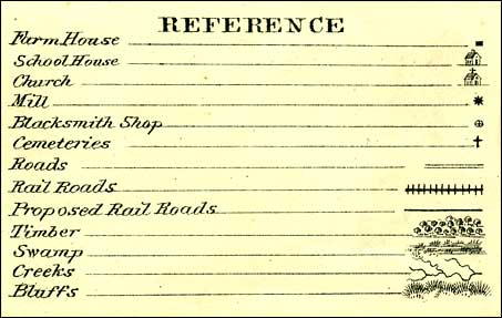
These images of Adair County Townships come from a plat map from a 1875 Andreas Iowa Plat Map Book. They show the locations of churches, schools, farmhouses, mills, blacksmith shops, cemeteries, railroads, proposed railroads, swamps, timber and bluffs. I will be adding 1904 maps as I finish them. Email me if you have a particular 1904 Township that you would like to see.
Home | What's
New | Post
Cards | Schools | Photo
Index | Patriotic | Maps|
Biographies | Media
page | Guest Book | Calendar
|
||||||||||||||||||||

