4/17/2009
Landmark information
- Location:
SE corner of Market St and Pacific Hwy (State Hwy 163), San Diego - Plaque:
Official State Plaque - Site:
Nothing Remains - Date First Visited:
12/2/1996 - Date Most Recently Visited:
4/17/2009 - GPS Coordinates:
N 32 42.676, W 117 10.254
About this landmark
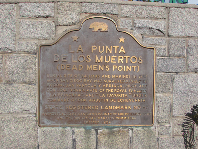
Plaque text:
La Punta de Los Muertos
(Dead Men's Point)
Burial site of sailors and marines in 1782 when San Diego Bay was surveyed & charted by Don Juan Pantoja y Arriaga, pilot, and Don Jose Tovar, mate, of the royal frigates "La Princesa" and "La Favorita" under command of Don Agustin de Echeverria.