5/6/2009
5/6/2009
5/6/2009
Landmark information
- Location:
7.4 mi W of Hwy 395 on Garlock Rd, 13.4 mi NE of the Cantil post office - Plaque:
Official State Plaque - Site:
Existing - Date First Visited:
5/22/1997 - Date Most Recently Visited:
8/5/2014 - GPS Coordinates:
N 35 24.145, W 117 47.430
About this landmark
Plaque text:
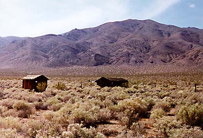
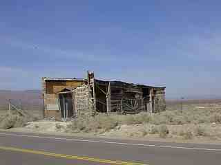
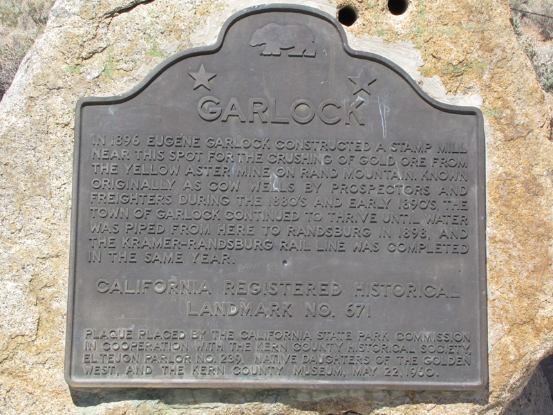
Garlock
In 1896 Eugene Garlock constructed a stamp mill near this spot for the crushing of gold ore from the Yellow Aster Mine on Rand Mountain. Known originally as Cow Wells by prospectors and freighters during the 1880's and early 1890's, the town of Garlock continued to thrive until water was piped from here to Randsburg in 1898, and the Kramer-Randsburg rail line was completed in the same year.