Thursday, August 29 -- U.S. 302 at Crawford Notch to Zealand Hut -- 7.7 miles
Left Crawford Notch trailhead about 9:45. Some uphill but the trail was relatively nice. Passed Ethan Pond cutoff at 11:15 -- trail much faster than other side of notch. Lots of bog bridges and not much rock. An easy day. Westher overcast and about 60º. Had lunch 45 minutes. Trail continued to be easy almost all the way to Zealand Notch hut. Reached the hut about 2:15. Some sprinkles for last hour of hike; started raining seriously after I got to hut. Some rough spots and steep quarter mile climb to hut at end. Small hut; not terribly scenic immediate area, not that many people. Had interesting conversation with thru-hiker that night. Didn't use trail name; said don't wait for someone to give you one, just pick one and start using it. So, at Pam's suggestion, I am Snowbird.
Friday, August 30 -- Zealand Hut to Garfield Ridge Campsite -- 9.7 + 0.1 miles
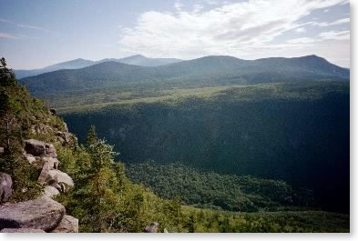
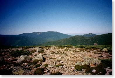
Left Zealand about 8:00 (need to be more organized about departure -- left without water). Steady up to beautiful view back to Zealand Notch, then up to Mt. Guyot at 10:45. Beautiful 360º views, clear sky with a few clouds, temperature about 60º. Trees wet during first couple of hours; trail had some wet spots. Had lunch 45 minutes between Guyot and South Twin. Over South Twin at 1:15 and steep down to Galehead Hut at 2:30. Pain-in-the-ass trail between Galehead and Garfield. Lots of pointless ups and downs going nowhere. Steep rocky up to Garfield -- there shortly after 5:00. Was really dragging last hour of day. Spent the night at shelter at Garfield Ridge Campsite with one thru-hiker (Ranger) and a gentleman from Massachusetts who was bagging 4000-footers. Garfield lives up to reputation for rough steep trail. (Questions: what do thru-hikers say to each other? Who has the right-of-way?)
|
| Zealand Notch from Zealand Ridge |
 |
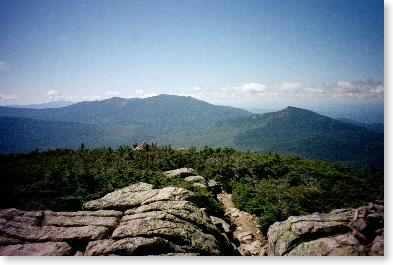
| Franconia Range (Mt. Lafayette the tallest peak) and Garfield from Mt. Guyot |
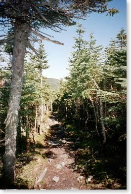 |
| Through the woods near treeline |
 |
| Mt. Washington in the distance from summit of South Twin |
Saturday, August 31 -- Garfield Ridge Campsite to U.S. 3 (Franconia Notch) -- 10.3 + 0.6 miles
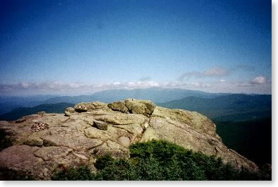
Cloudy and in low 50s. Should burn off. Off at 7:45. Over Garfield (not bad -- one steep ledge). Up and over a couple of bumps and up Lafayette. At summit of north peak about 10:45. Mostly in soft clouds; very quiet and peaceful. Occasional blue sky. Stunning setting. Not round/broad summits like Presidentials; drops off on both sides. To top of Lafayette at 11:20. Spent an hour there for lunch. Clear in spots at times, temperature around 55º; hardly any breeze. Could occasionally see panoramas over to Cannon Mtn., to east, and back to Garfield. Continued along Franconia Ridge. Entire ridge was very pleasant, although mostly socked in. Very few hikers on the trail past the ridge toward Liberty Spring -- thought I was lost. Had planned to stay at Liberty Spring Campsite but decided to go down to Franconia Notch given the time I had rather than camp there and come down in a.m. as planned. Steep downhill, not easy on the body. Got out about 6:00 and had unexpected half-mile hike over typical rooty trail to rendezvous spot. Was very tired; fell and broke camera. Might have been a good idea to not tackle the downhill after all. (Hike speed -- biggest variable is trail condition, not necessarily slope.)
 |
| Getting closer: Franconia Range and Garfield from South Twin |
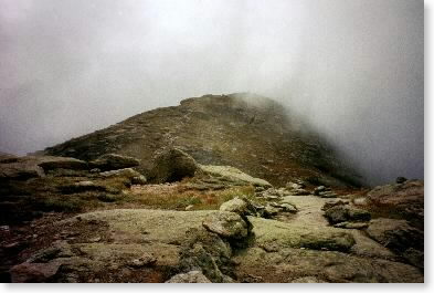 |
| Headed up Mt. Lafayette (Franconia Range) |
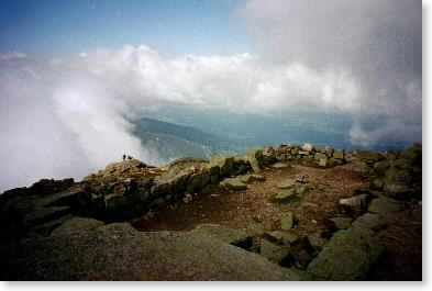 |
| Foundation and view from summit of Lafayette |
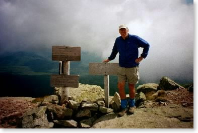 |
| Snowbird summits Lafayette |
Sunday, September 1 -- Tuesday, September 3 -- travel days
(Drove to Twin Pond Motel in Farmington, Maine -- my wife's home for the next five weeks. Sunday and Monday we spent getting set up and organized. Tuesday we drove to Millinocket near Baxter State Park and prepared for my assault on Mt. Katahdin and my trip through the Hundred Mile Wilderness.)