Friday, September 27 -- Maine 4 near Rangeley to Sabbath Day Pond Lean-to -- 9.4 miles
Left road about 8:20. Expecting rain, but weather wasn't bad -- even saw a little bit of blue sky. Passed Little Swift River Pond campsite about 11:00. Had lunch (leftover pizza, no less) 11:30 to 12 noon. Rain started a little after noon -- not heavy, more of a nuisance. Through softwood forests most of the day. At Sabbath Day Pond Lean-to about 2:20. One other occupant (Gourmet Dan), complete with portable TV, digital video editor, medium format camera etc. etc. He didn't seem to hike very fast for a thru-hiker. Rain heavier but still not what I'd call a downpour. Two other thru-hikers in later (Blueberry and Werewolf). Knees held up well -- no pain. [Afternote: Sabbath Day Pond Lean-to turned out to be almost exactly my hike mid-point.]
Saturday, September 28 -- Sabbath Day Pond Lean-to to Bemis Mountain Lean-to -- 8.3 miles
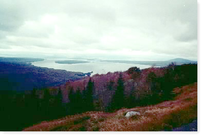
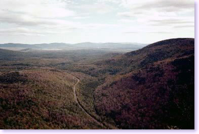
Rained hard in middle of night, but was pretty well over by dawn. Few puddles and not much runoff; most was absorbed by ground. Off at 7:45 through random woods and by a couple of ponds. Out onto Maine 17 by 10:00 with beautiful view north to Mooselookmeguntic Lake. A little sun in distance, still mostly gray and in 50s. Down to Bemis Stream -- actually had to ford due to high water, although I probably could have walked logs. Lunch here 11:00 to 11:45. Had been hearing about how there was no water at Bemis Mtn. Lean-to, so I watered up just in case and started up Bemis Mountain. Some ledgy stuff; lots of open rock. Misty weather along ridge; finally cleared about 2:30. Absolutely no shortage of water on the trail or by shelter. Arrived at shelter 2:45. Filled up with four other southbounders and a couple of northbounders. Cool evening.
|
| View toward Mooselookmeguntic Lake |
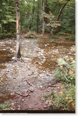 |
| Bemis Stream: The one stream I had to ford |
Sunday, September 29 -- Bemis Mountain Lean-to to near Black Brook -- 8.7 miles
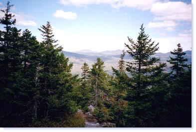
Up early (and several times in the night) due in part to cold. Was right at freezing at 6 a.m. Off by 8:00 a.m. Clear, cool, and breezy. Took a while to get into the 40s. Over several peaks of Bemis Mountain and passed through old-growth red spruce forest. Up to summit of Old Blue Mountain for lunch shortly after noon. Called Pam to try to get Giants schedule to see if jamming a day made sense. Could not come to a conclusion due to lack of information. Beautiful views from Old Blue. Afternoon was one long downhill from 3600 to 1500 feet. Last mile down into Black Brook Notch quite steep and dramatic (getting cloudy and cool again). Was going to continue on, but it was after 3:00 when I crossed South Arm Road and my knees were aching, so I decided to camp here (as originally planned) and forgo saving a day. Camped in open sandy area near Black Brook.
 |
| Spruce forest on Bemis Mountain |
 |
| View from Old Blue |
 |
| View from above Black Brook Notch |
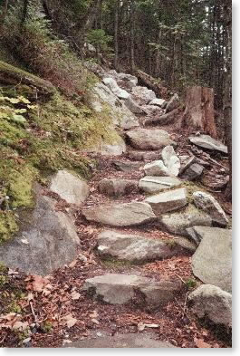 |
| Trail |
Monday, September 30 -- Near Black Brook to near Surplus Pond -- 8.2 miles
Up a little later than usual. A.m. not as cool as yesterday (40º). Who should show up but Gourmet Dan? Off about 8:30. Steep up (about one hour) over Moody Mountain then **very** steep down to Sawyer Brook. Steep stretch was well improved with ladders, rock hardware, etc., but was still *steep*. At bottom about 10:45 -- would have been absolute killer coming down that steep stretch at the end of the day. Weather mostly cloudy, in 50s. Up steep slope to Hall Mountain Lean-to for lunch -- there at 12:15 for lunch for one hour. Who should show up there (again) -- this time slacking? You guessed it - Gourmet Dan. Rest of day up along ridge, first through hardwoods, then spruce, then hardwoods. Ran into Idaho Joe, who was also slacking. Hiked with him to Surplus Pond. Arrived there about 4:00. Bigfoot also passed by (he was slacking too). Camped under trees near pond. Drizzle started after dinner -- didn't last.
(In my notebook I also made a note that in the morning, I had done 2400 vertical feet up and 1200 vertical feet down in four miles, and that from lunch Sunday to lunch Monday, I had done 2400 vertical feet up and 3400 vertical feet down in one 24-hour period.)
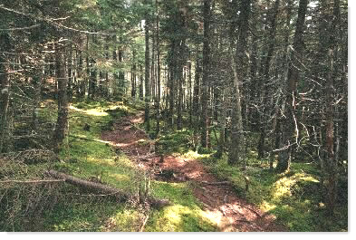 |
| Trail near Surplus Pond |
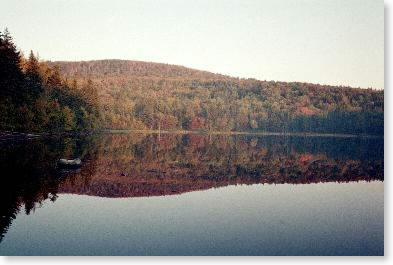 |
| Surplus Pond |
Tuesday, October 1 -- Near Surplus Pond to Baldpate Lean-to -- 9.9 miles
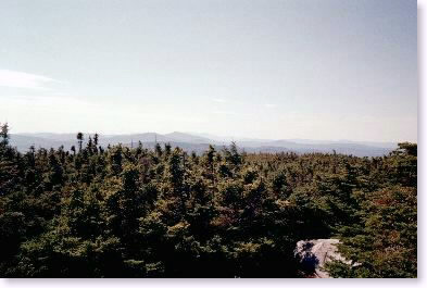
Up early -- warm and actually dry. Beautiful sunrise and light on the pond. Took it easy and left about 8:00 -- morning trails were nice. Made it down to East B Hill Road in one hour and all the way to Frye Notch Lean-to by noon. Good trail up from Dunn Notch -- felt like Vermont. Decided to go on and over Baldpate Mountain. Very nice day -- sunny, hazy, temperature about 70º. Decent views from Baldpate -- lots of rock walking up to top, over, and up west peak. Down to Baldpate Lean-to by 4:30. In shelter with the Mad Professor (a retired music professor from the midwest) and Bigfoot. Found trash left behind by a hiker who shall remain nameless who got ahead of us and who had still not grasped the "carry out what you carry in" concept.
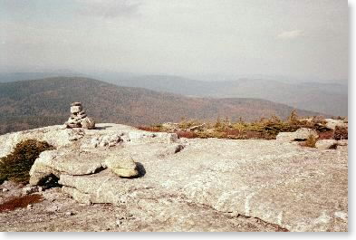 |
| View from Baldpate Mountain summit |
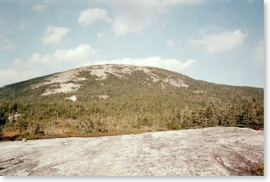 |
| Baldpate Mountain |
Wednesday, October 2 -- Baldpate Lean-to to Maine 27 through Grafton Notch -- 2.3 miles
Rain showers before dawn (with lightning as well). Trails dried quickly. Down and out in 1-1/3 hours. Overcast, humid, peaks in the clouds, 70º. Off trail the rest of the day and p.m.